


PHOENIX — We're tracking a winter storm moving through Arizona!
Got weather photos or videos you want to share? Send them to share@abc15.com
With rain and snow likely impacting road travel and outdoor activities, Saturday is an ABC15 Weather Action Day. Take action to prepare for this storm and adjust your plans as needed.
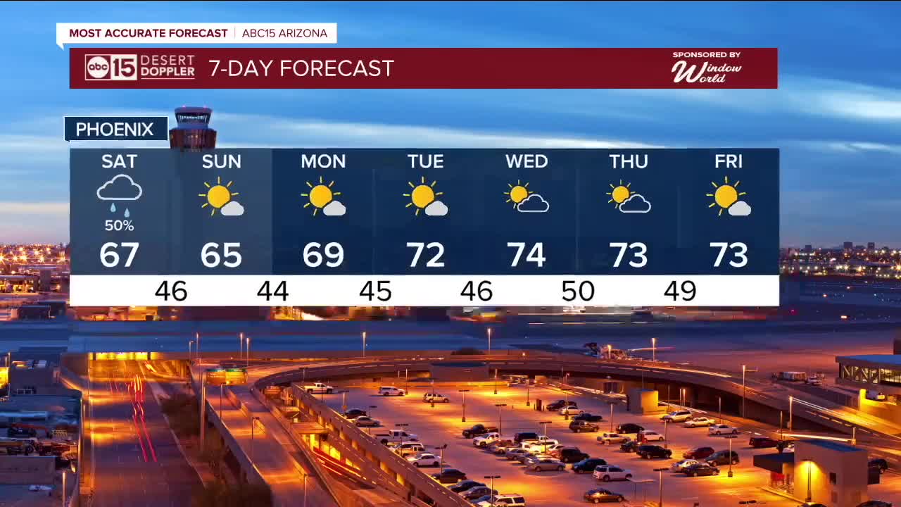
Here in the Valley, we've only seen a few hundredths of an inch of rain so far, but there are still chances for showers and isolated thunderstorms through Saturday night.
Across the high country, snow levels are lowering to around 5,000 feet with accumulating snow for areas above 6,000 feet in elevation.
Hazardous road conditions are expected along the Mogollon Rim and in the White Mountains through early Sunday morning.

Winter Weather Advisories are in effect for portions of eastern and southeastern Arizona through Sunday morning, including near the White Mountains. Three to 12 inches of snow is possible for areas above 6,500 feet in elevation.
Another Winter Weather Advisory is in effect for the Chuska Mountains and Defiance Plateau through Saturday evening, where two to six inches of snow is possible.

Winds are picking up a bit, too. Gusts will top out near 25 mph in the Valley and near 30 mph across the high country.
The cooler air with this storm will finally get temperatures back down near normal for this time of year.
Expect highs in the mid to upper 60s in the Valley Sunday and Monday before the 70s return next week.
Want more news in your community? Add ABC15 as a preferred source on Google below:
![]()

