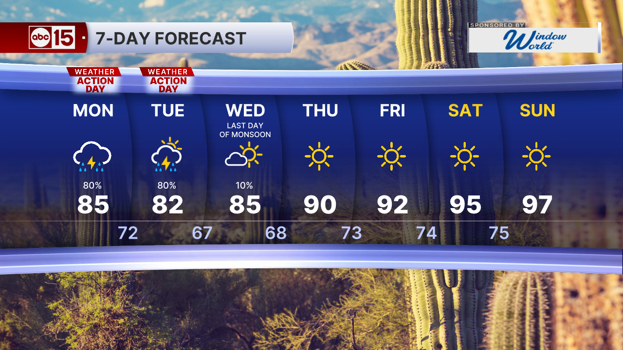


Get ready for some big weather changes across the state today and Tuesday!
Moisture from the remnants of Hurricane Odalys has already moved in from the south, bringing clouds and showers to parts of Arizona this morning.
Moisture from Hurricane Polo and a Pacific storm system will also move in, and the combination of these systems will fuel showers and thunderstorms across the state. Today and Tuesday are ABC15 Weather Action Days.

Tuesday morning looks to bring our best chance for widespread and heavy rainfall in the Valley, right in time for the morning commute.

Parts of the Valley could pick up a half inch to an inch of rain. Some areas in northern and eastern Arizona could get two to three inches.

Flood Watches are in effect for most of the state through Tuesday. Never drive through flooded roads or washes.
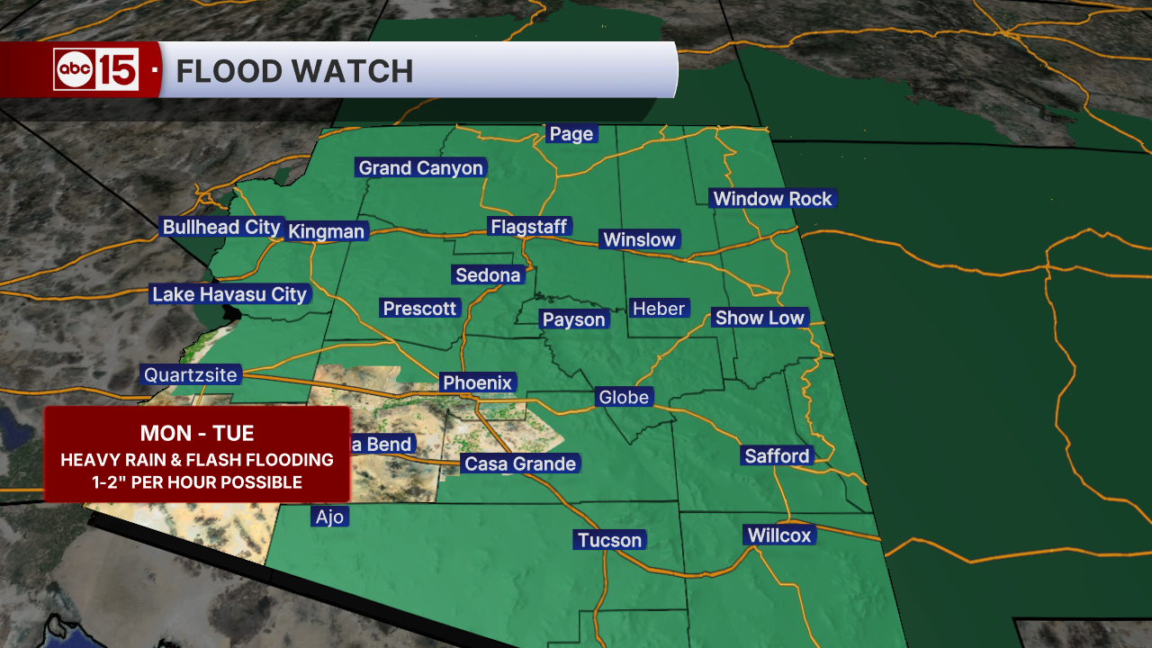
With heavy downpours possible, washes and small creeks could start flowing quickly, and some low-lying spots may see flash flooding.

Drier air moves in Wednesday, the last official day of monsoon season, and highs climb from the 80s to the upper 90s by Sunday.

Want more news in your community? Add ABC15 as a preferred source on Google below: