


Big changes are coming as a storm system moves into Arizona.
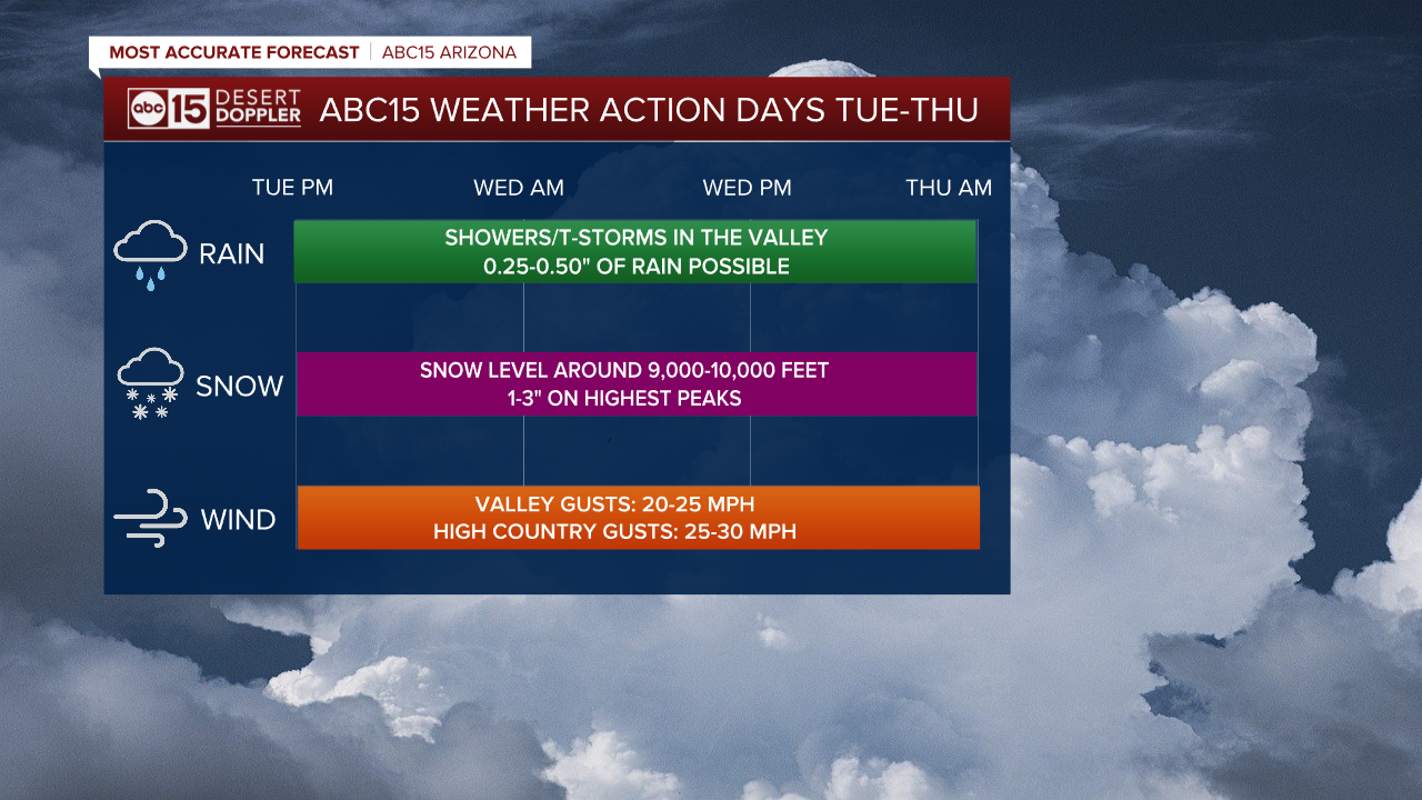
With potential impacts to holiday travel and outdoor events across Arizona, Tuesday, Wednesday and Thursday are ABC15 Weather Action Days. Take action and adjust your plans as needed to stay safe in the storm.

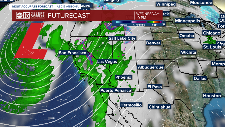
The first round of rain moved in Tuesday evening and chances for more will continue overnight into Wednesday morning.
The next round of rain could move in Wednesday night into Thursday morning across the Phoenix metro area. There is also a chance of a few isolated thunderstorms in the mix, too.
Some Valley neighborhoods could pick up a quarter to a half an inch of rain, with higher totals possible across parts of northwestern Arizona.
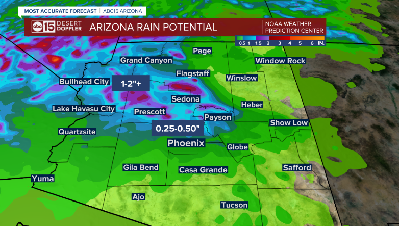
A Flood Watch is in effect for Mohave County Wednesday morning through Thursday morning, where excessive runoff could lead to flooding in low-lying and flood-prone areas.

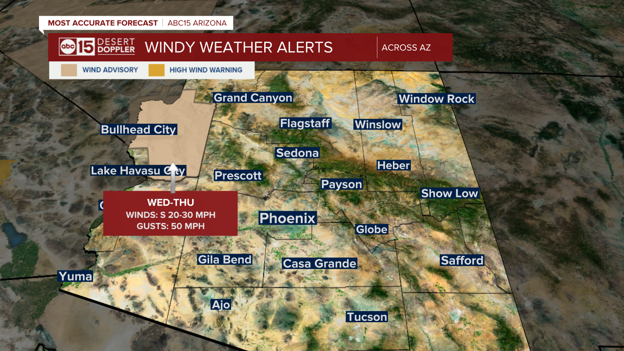
Winds will pick up a bit by Wednesday, with gusts near 25 mph across the Valley, up to 30 mph in the high country.
Across northwestern Arizona, winds could gusts as high as 50 mph and a Wind Advisory is in effect for Christmas Eve and Christmas Day in Mohave County.
Snow levels with this storm system will remain high at 9,000 to 10,000 feet, so Flagstaff will likely only see rain.
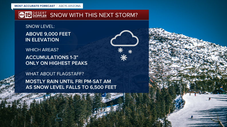
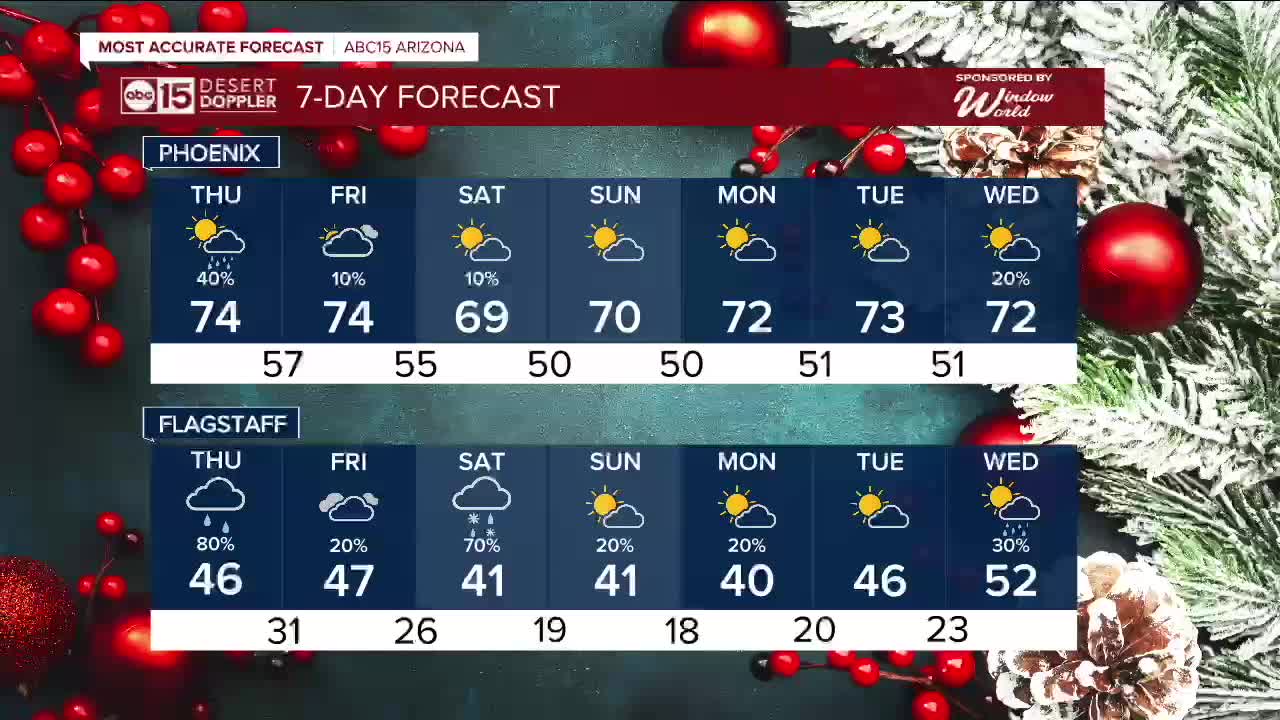
There are some lingering chances for precipitation up there into the weekend, and by then we could see some snow flakes come down as colder air settles in.
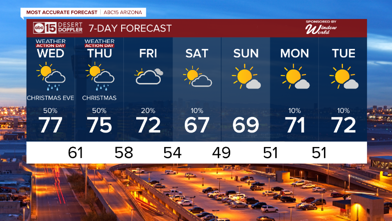
Here in the Valley, daytime highs will fall into the low 70s by Friday before dropping into the upper 60s over the weekend.
Overnight temperatures will get colder too, with lows falling into the 40s in Phoenix by Sunday morning.
See the full weather section here.
Want more news in your community? Add ABC15 as a preferred source on Google below:
![]()

