

PHOENIX — Cooler air is settling in behind our latest storm.
We have one more day below normal, then high pressure will take over and send temperatures soaring.
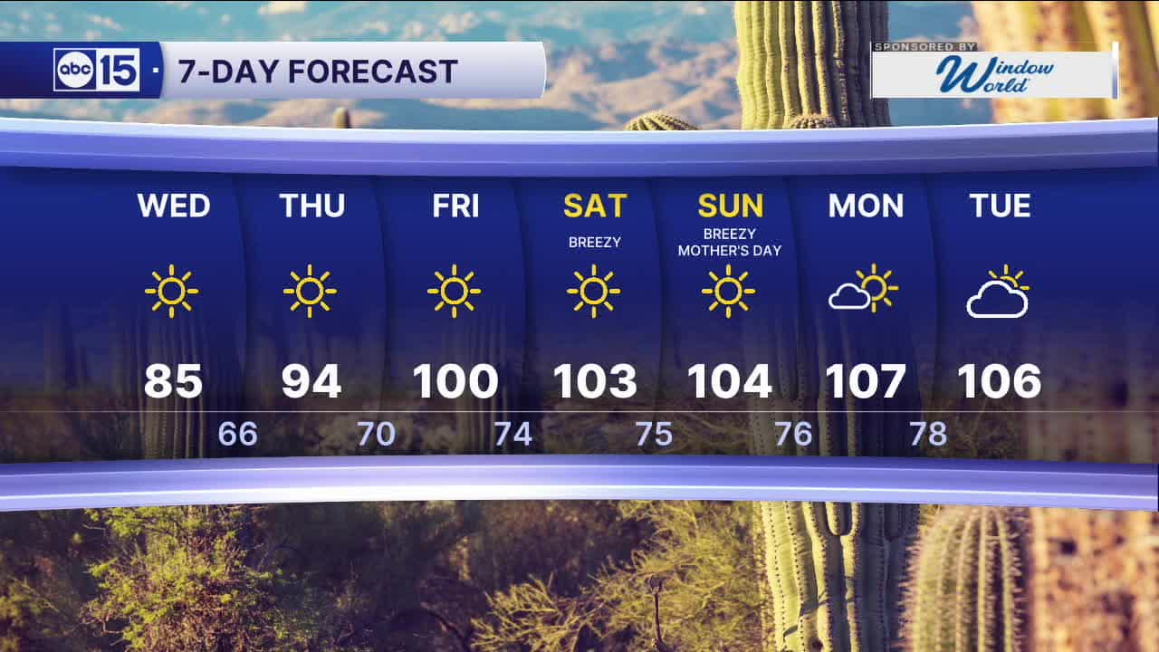
Here in the Valley, temperatures will top out in the mid 80s on Wednesday before climbing to 100 degrees by Friday.
Breezes will pick up over Mother's Day weekend as temperatures continue to sizzle.
By Monday, we could see our hottest day of the year so far with a high of 107 degrees in Phoenix.
On average, it doesn't get that hot in Phoenix until the end of May. But, this year we've already hit 105 degrees three times in March, marking the earliest on record.


2026 Sky Harbor Official Rainfall to date: 0.32" (-2.49" from average)
__________________________________________
Daily rainfall reports from all across the Valley can be found here.
__________________________________________
PHOENIX IS GETTING DRIER - LOWER RAINFALL AVERAGES NOW
Average Monsoon Rainfall in Phoenix (1981-2010): 2.71" of rain
NEW Average Monsoon Rainfall in Phoenix (1991-2020): 2.43" of rain
Average Yearly Rainfall in Phoenix (1981-2010): 8:03" of rain
NEW Average Yearly Rainfall in Phoenix (1991-2020): 7.22" of rain
__________________________________________
Share your weather photos and videos with us anytime: share@abc15.com.
______________________________________
