

PHOENIX — A storm system is moving in and bringing wind, rain and cooler air to Arizona.
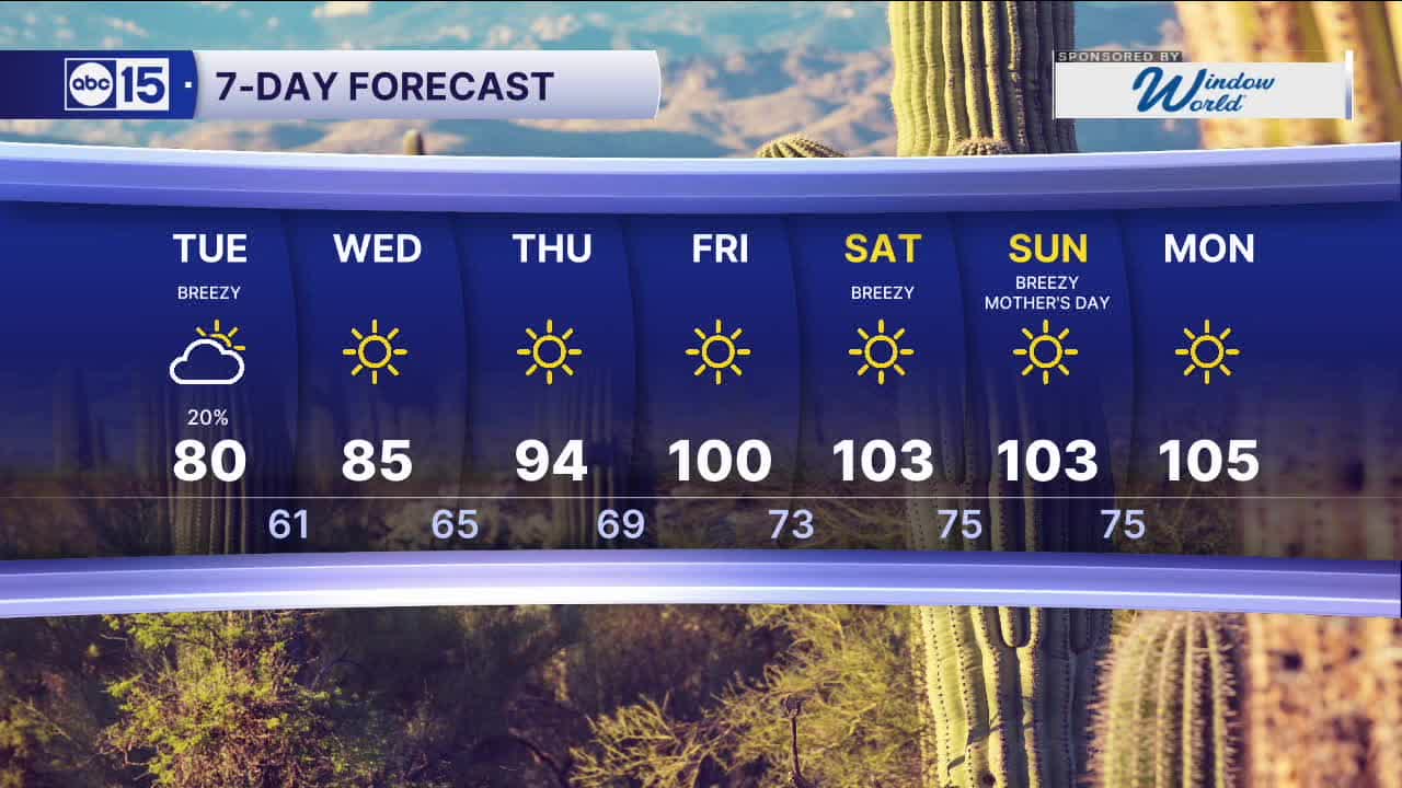
Here in the Valley, there is a slight chance of light rain showers overnight into Tuesday morning.
Up north, scattered showers and thunderstorms will fire up along the Mogollon Rim and into northeastern Arizona on Tuesday afternoon.
Breezes are picking up, too. Gusts here in the Valley could hit 20 to 25 mph.
With winds mainly out of the west-southwest, smoke from the Hazen Fire burning near Buckeye will continue to impact the West Valley and parts of Phoenix.
This storm is also bringing a lot of cooler air with it, dropping temperatures nearly 20 degrees in parts of our state.
Phoenix hit 98 degrees on Sunday and has so far only made it to 80 on Monday afternoon.
We'll fall into the 60s overnight before climbing back up to 80 degrees on Tuesday afternoon.
High pressure will start to build in behind this storm, sending temperatures soaring into the 90s by Thursday and into the triple digits over Mother's Day weekend.


2026 Sky Harbor Official Rainfall to date: 0.32" (-2.48" from average)
__________________________________________
Daily rainfall reports from all across the Valley can be found here.
__________________________________________
PHOENIX IS GETTING DRIER - LOWER RAINFALL AVERAGES NOW
Average Monsoon Rainfall in Phoenix (1981-2010): 2.71" of rain
NEW Average Monsoon Rainfall in Phoenix (1991-2020): 2.43" of rain
Average Yearly Rainfall in Phoenix (1981-2010): 8:03" of rain
NEW Average Yearly Rainfall in Phoenix (1991-2020): 7.22" of rain
__________________________________________
Share your weather photos and videos with us anytime: share@abc15.com.
______________________________________
