

PHOENIX — Strong winds and low humidity are keeping fire danger high across Arizona to start the week.
Red Flag Warnings are in effect through Tuesday evening for much of northern Arizona. Wind gusts could reach up to 45 mph, while relative humidity drops into the single digits. These are conditions that can quickly spread wildfires.
Use extreme caution. A single spark can ignite a fast-moving wildfire. Do not flick cigarettes out the window and should make sure nothing is dragging from your vehicle that could cause a spars.
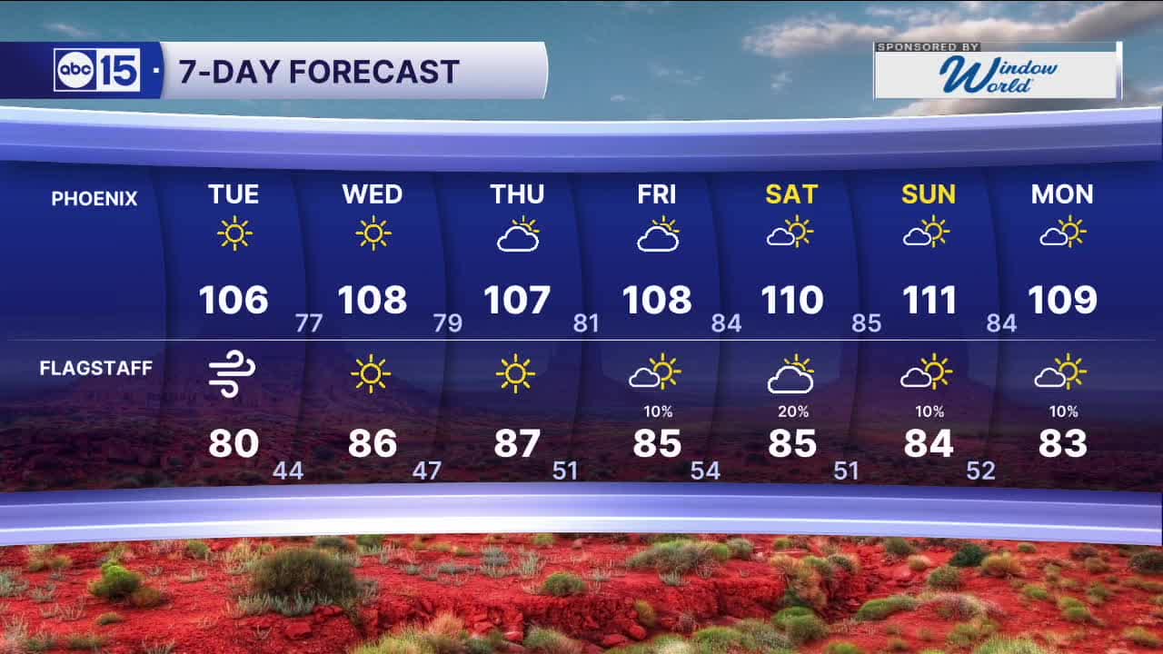
As high pressure returns by the end of the week, our Valley heat will get even hotter.
Phoenix could it 110-degrees for the first time this year by Saturday (which is right on cue with our average first 110-degree day of June 11.)
With extreme heat in the forecast make sure to stay hydrated and stay inside as much as possible during the late morning and afternoon hours.


2026 Sky Harbor Official Rainfall to date: 0.32" (-2.60" from average)
__________________________________________
Daily rainfall reports from all across the Valley can be found here.
__________________________________________
PHOENIX IS GETTING DRIER - LOWER RAINFALL AVERAGES NOW
Average Monsoon Rainfall in Phoenix (1981-2010): 2.71" of rain
NEW Average Monsoon Rainfall in Phoenix (1991-2020): 2.43" of rain
Average Yearly Rainfall in Phoenix (1981-2010): 8:03" of rain
NEW Average Yearly Rainfall in Phoenix (1991-2020): 7.22" of rain
__________________________________________
Share your weather photos and videos with us anytime: share@abc15.com.
______________________________________
