

PHOENIX — Even before the monsoon officially begins on June 15th, moisture is surging into Arizona.
Dew points are up across southwestern Arizona and rain chances are moving in.
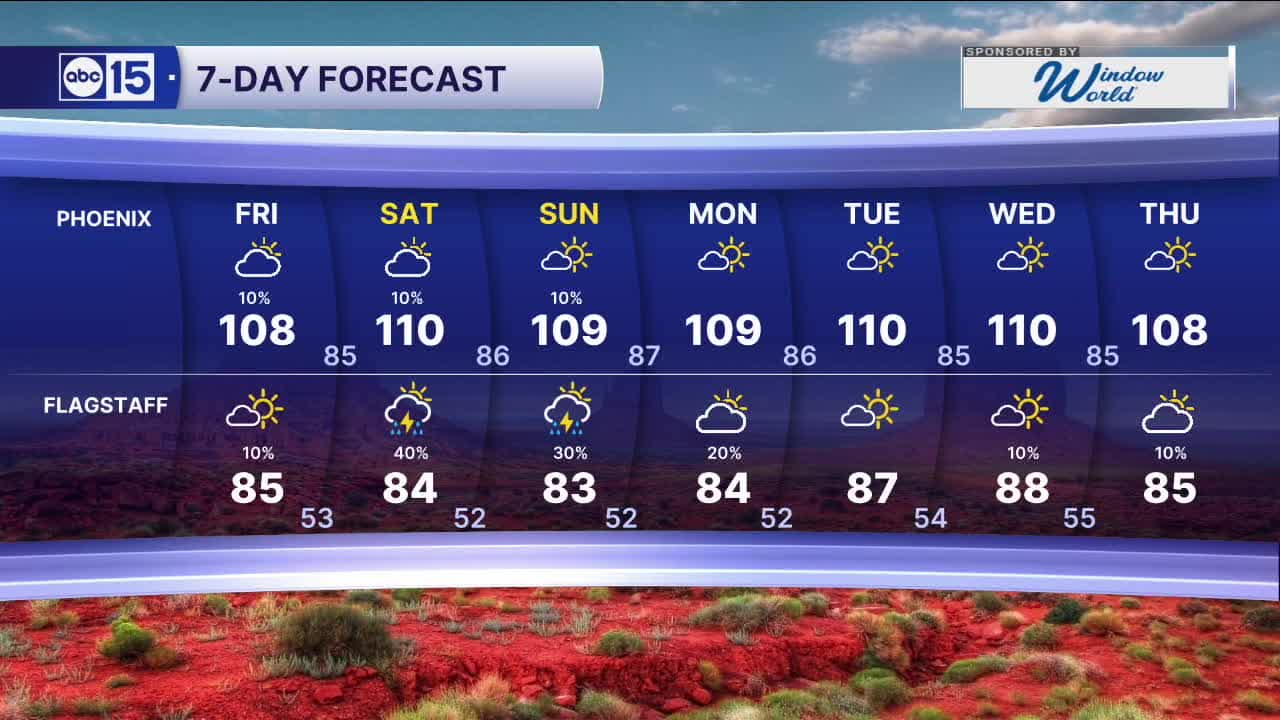
Here in the Valley, we could even see a few isolated showers on Friday, Saturday or Sunday.
We're not expecting much measurable rain, but we could see gusty winds, areas of blowing dust and dry lightning that could spark wildfires.
Up north, we could see some measurable rain in parts of the high country as storm chances ramp up over the weekend.
Temperatures will stay hot, too.
Phoenix may see its first 110-degree day of the year either over the weekend or early next week.
On average, our first 110-degree day happens around June 11th.


2026 Sky Harbor Official Rainfall to date: 0.32" (-2.60" from average)
__________________________________________
Daily rainfall reports from all across the Valley can be found here.
__________________________________________
PHOENIX IS GETTING DRIER - LOWER RAINFALL AVERAGES NOW
Average Monsoon Rainfall in Phoenix (1981-2010): 2.71" of rain
NEW Average Monsoon Rainfall in Phoenix (1991-2020): 2.43" of rain
Average Yearly Rainfall in Phoenix (1981-2010): 8:03" of rain
NEW Average Yearly Rainfall in Phoenix (1991-2020): 7.22" of rain
__________________________________________
Share your weather photos and videos with us anytime: share@abc15.com.
______________________________________
