

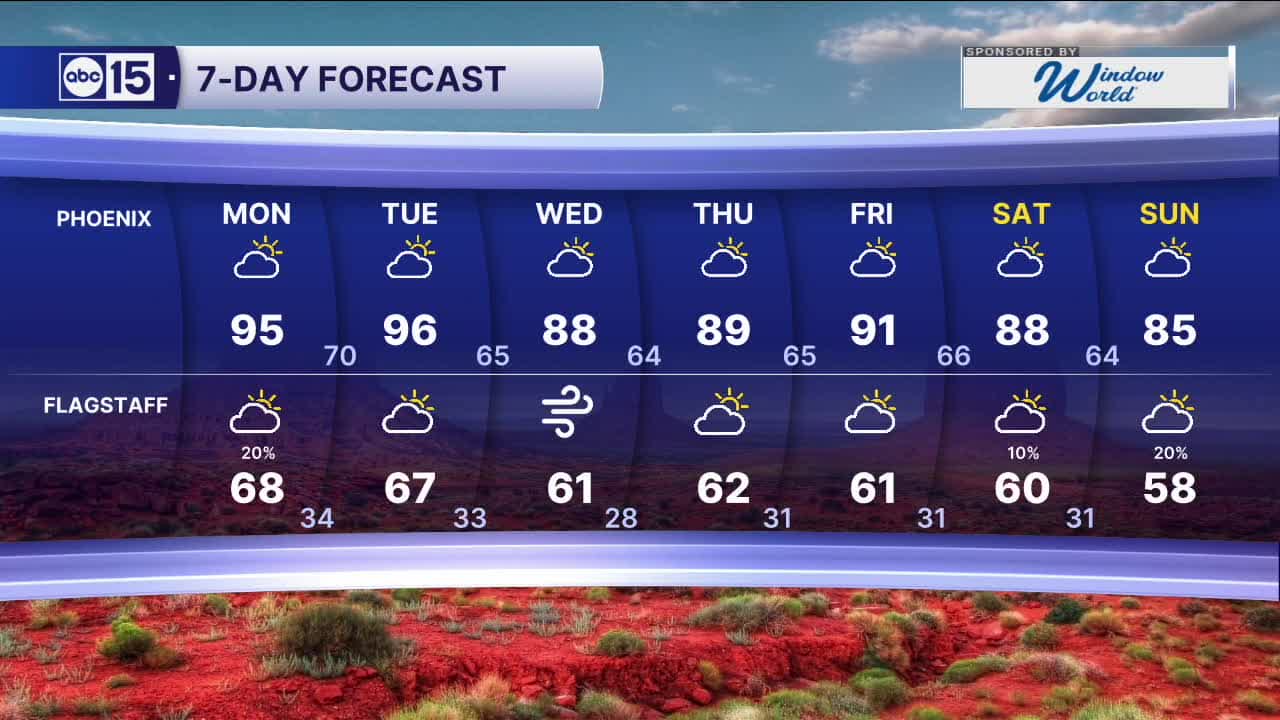


PHOENIX — High pressure will remain in control to start the week, keeping afternoon highs in the Valley in the mid-90s. If you have outdoor plans, be sure to wear sunscreen and drink plenty of water.
Looking ahead, breezy conditions will continue into early next week. Winds shifting out of the southwest could bring a few stray to isolated showers along the Mogollon Rim and into the White Mountains on Monday.
A storm system passing to our north midweek will bring a slight cooldown after Tuesday, with highs dropping back into the 80s. Winds will also once again pick up. At this time, rain and snow are not expected.
However, as the system splits, it could open the door for additional storm chances next weekend, which we will continue to monitor.
Stay tuned for updates as we get closer.


2026 Sky Harbor Official Rainfall to date: 0.32" (-2.44" from average)
__________________________________________
Daily rainfall reports from all across the Valley can be found here.
__________________________________________
PHOENIX IS GETTING DRIER - LOWER RAINFALL AVERAGES NOW
Average Monsoon Rainfall in Phoenix (1981-2010): 2.71" of rain
NEW Average Monsoon Rainfall in Phoenix (1991-2020): 2.43" of rain
Average Yearly Rainfall in Phoenix (1981-2010): 8:03" of rain
NEW Average Yearly Rainfall in Phoenix (1991-2020): 7.22" of rain
__________________________________________
Share your weather photos and videos with us anytime: share@abc15.com.
______________________________________
