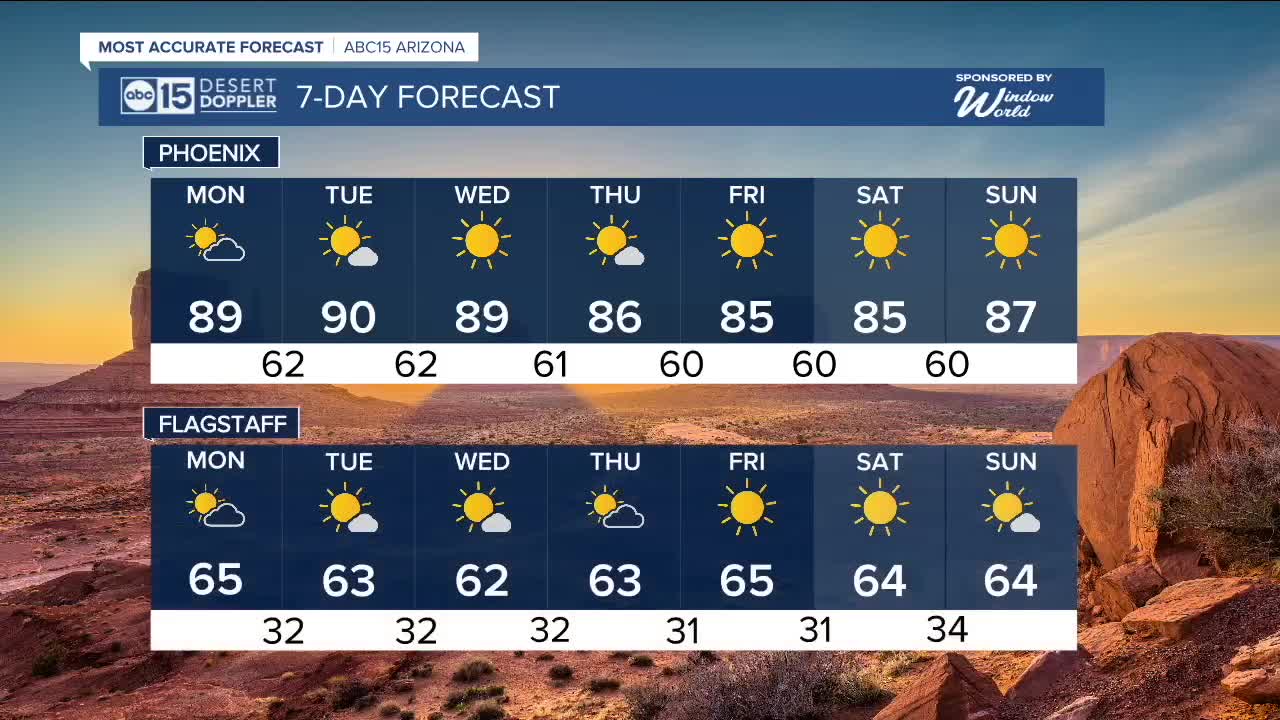


PHOENIX — After a warm weekend for the Valley, we are set to continue seeing afternoon temperatures 5-8 degrees above average through Wednesday as high pressure builds across the Southwest.
While high pressure does build, a short-wave of energy is moving along the coast of California, which will bring in high cirrus clouds across the state on Monday. This could keep us just shy of reaching 90 degrees.
Fortunately, morning lows will still feel great as they will be in the lower to mid-60s. While you will need a light jacket to start the day, afternoon highs will be in the upper 80s and lower 90s through Wednesday.
Typically, Phoenix records its last 90-degree day around October 30, though it has happened as late as mid-November — most recently in 2020.
By late week, the ridge of high pressure will shift eastward, allowing daytime highs to settle back into the mid to lower 80s — still a few degrees warmer than average for early November.


_________________________________________
2025 Sky Harbor Official Rainfall to date: 7.49" (+1.54" from average)
Monsoon 2025 Sky Harbor Official Rainfall: 2.76" (+0.33" from average)
__________________________________________
Daily rainfall reports from all across the Valley can be found here.
__________________________________________
PHOENIX IS GETTING DRIER - LOWER RAINFALL AVERAGES NOW
Average Monsoon Rainfall in Phoenix (1981-2010): 2.71" of rain
NEW Average Monsoon Rainfall in Phoenix (1991-2020): 2.43" of rain
Average Yearly Rainfall in Phoenix (1981-2010): 8:03" of rain
NEW Average Yearly Rainfall in Phoenix (1991-2020): 7.22" of rain
__________________________________________
Share your weather photos and videos with us anytime: share@abc15.com.
______________________________________
