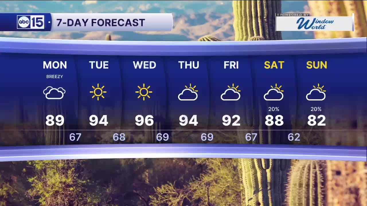


PHOENIX — After a very warm weekend in the 90s, a weak disturbance will move across Arizona on Monday, bringing cloudy skies, spotty showers, and breezy winds.
Clouds will increase overnight into Monday morning, leading to mostly cloudy conditions through the day. The Valley is expected to stay dry, but a few showers could develop along Interstate 40 from Flagstaff to the New Mexico border.
Most of these showers will be light, though a few could produce brief downpours and occasional lightning.
In the Valley, temperatures will start in the lower 70s and warm to around 89 degrees by the afternoon. Cloud cover will help keep highs a bit more moderate.
Winds will be breezy across the state, including the Valley. Expect sustained winds of 10 to 20 mph out of the east, with gusts up to 25 mph.
After this weak system moves out, high pressure builds back in by midweek, bringing clearing skies and pushing temperatures back into the 90s through the rest of the week.
Looking ahead, another storm system could approach the West Coast by the end of the week, potentially bringing a chance of showers to parts of Arizona next weekend.
Stay tuned for updates as the forecast evolves.


2026 Sky Harbor Official Rainfall to date: 0.32" (-2.31" from average)
__________________________________________
Daily rainfall reports from all across the Valley can be found here.
__________________________________________
PHOENIX IS GETTING DRIER - LOWER RAINFALL AVERAGES NOW
Average Monsoon Rainfall in Phoenix (1981-2010): 2.71" of rain
NEW Average Monsoon Rainfall in Phoenix (1991-2020): 2.43" of rain
Average Yearly Rainfall in Phoenix (1981-2010): 8:03" of rain
NEW Average Yearly Rainfall in Phoenix (1991-2020): 7.22" of rain
__________________________________________
Share your weather photos and videos with us anytime: share@abc15.com.
______________________________________
