

PHOENIX — Changes are on the way as back-to-back storm systems approach Arizona.
The first storm system will clip by this weekend, bringing more clouds, cooler air and a chance of spotty showers to parts of Arizona.
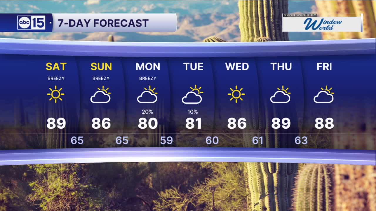
Here in the Valley, our rain chances will hold off until Monday and Tuesday as a second, colder storm system moves in from the northwest.
Winds will pick up, too. Expect breezy conditions over the next few days as these storm systems pass by.
A Wind Advisory is in effect for the Colorado River Valley in Mohave County until 9 p.m. on Saturday. Winds gusts could top 35 mph with 1 to 3 foot waves expected on Lake Mohave and Lake Mead on Saturday.
Increased winds and dry conditions will lead to heightened wildfire danger across southeastern Arizona.
Fire Weather Watches are in effect on Sunday from Casa Grande south to the Mexican border and across southeastern Arizona to the New Mexican border. Watch out for gusts near 40 mph.
The cooler air flowing in with these storms will drop Valley temperatures into the 80s Saturday and Sunday with a few Valley locations in the 70s by the start of next week.


2026 Sky Harbor Official Rainfall to date: 0.32" (-2.38" from average)
__________________________________________
Daily rainfall reports from all across the Valley can be found here.
__________________________________________
PHOENIX IS GETTING DRIER - LOWER RAINFALL AVERAGES NOW
Average Monsoon Rainfall in Phoenix (1981-2010): 2.71" of rain
NEW Average Monsoon Rainfall in Phoenix (1991-2020): 2.43" of rain
Average Yearly Rainfall in Phoenix (1981-2010): 8:03" of rain
NEW Average Yearly Rainfall in Phoenix (1991-2020): 7.22" of rain
__________________________________________
Share your weather photos and videos with us anytime: share@abc15.com.
______________________________________
