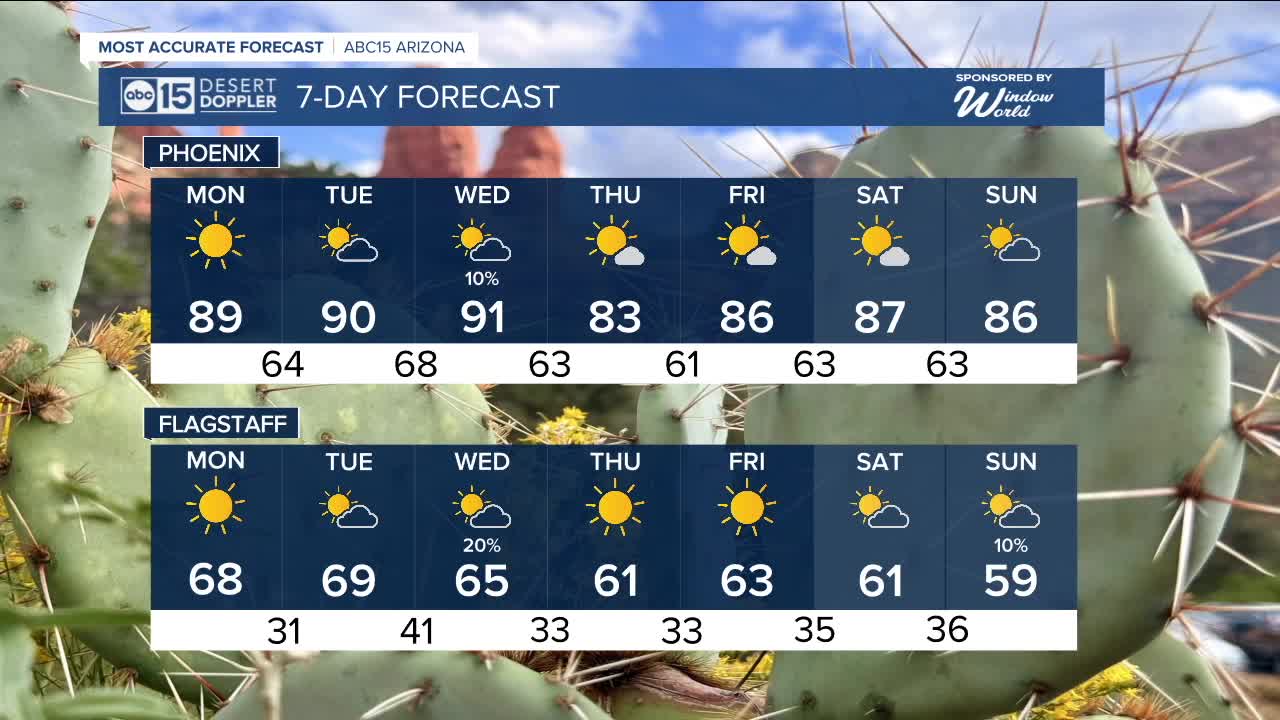


PHOENIX — Phoenix reached 90 degrees on Sunday, and more 90-degree weather is on tap to start the week.
High pressure is building in, pushing temperatures back into the 90s, making us a few degrees warmer than we should be this time of year. Morning lows will also steadily rise into the mid to upper 60s.
This brief warm-up will last through Wednesday before a storm system moves across the state, bringing a return to fall weather later in the week.
The system isn’t carrying much moisture, so rain chances will stay mainly over the high country and northern Arizona from Tuesday night into Wednesday.
There’s a slight chance—around 10 percent—of a stray shower in the Valley.
Behind the storm, temperatures will cool back into the low to mid-80s with overnight lows dropping into the mid to low 60s.


_________________________________________
2025 Sky Harbor Official Rainfall to date: 7.49" (+1.79" from average)
Monsoon 2025 Sky Harbor Official Rainfall: 2.76" (+0.33" from average)
__________________________________________
Daily rainfall reports from all across the Valley can be found here.
__________________________________________
PHOENIX IS GETTING DRIER - LOWER RAINFALL AVERAGES NOW
Average Monsoon Rainfall in Phoenix (1981-2010): 2.71" of rain
NEW Average Monsoon Rainfall in Phoenix (1991-2020): 2.43" of rain
Average Yearly Rainfall in Phoenix (1981-2010): 8:03" of rain
NEW Average Yearly Rainfall in Phoenix (1991-2020): 7.22" of rain
__________________________________________
Share your weather photos and videos with us anytime: share@abc15.com.
______________________________________
