



PHOENIX — A surge of moisture is bringing another round of storm chances to Arizona today.
Most of the storms will impact the high country northeast of the Valley and southwest Arizona, but there is a chance a few storms could impact parts of the Valley this morning and evening.
Watch out for gusty winds, blowing dust, cloud-to-ground lightning and brief downpours with any of the storms that move through.
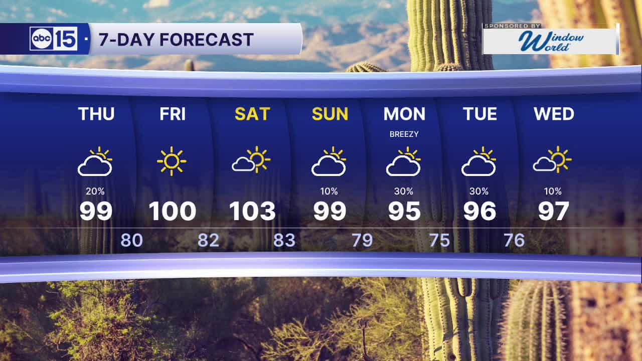
Phoenix will top out in the mid to upper 90s today, putting us right near normal for this time of year.
Drier air moves in Friday with a high near 98. The triple digits will be back Saturday with highs in the low 100s and sunny skies.
Then, tropical moisture and a trough of low pressure will bring cooler air and chances for storms late Sunday into early next week. Highs will drop into the low 90s by Monday.
Increased moisture from Hurricanes Polo and Odalys could increase the risk of heavy downpours on Monday and Tuesday. Stay tuned for updates as we get closer.


2026 Sky Harbor Rainfall to-date: 2.16" (-3.10" from average)
2026 Monsoon Rainfall to-date: 1.84" (-0.50" from average)
__________________________________________
Daily rainfall reports from all across the Valley can be found here.
__________________________________________
PHOENIX IS GETTING DRIER - LOWER RAINFALL AVERAGES NOW
Average Monsoon Rainfall in Phoenix (1981-2010): 2.71" of rain
NEW Average Monsoon Rainfall in Phoenix (1991-2020): 2.43" of rain
Average Yearly Rainfall in Phoenix (1981-2010): 8:03" of rain
NEW Average Yearly Rainfall in Phoenix (1991-2020): 7.22" of rain
__________________________________________
Share your weather photos and videos with us anytime: share@abc15.com.
______________________________________
