



PHOENIX — A late-season surge of monsoon moisture is bringing storm chances back to Arizona this week.
Showers and isolated thunderstorms will develop across eastern Arizona today, mainly in Gila County and the high country. Multiple rounds of rain over the same areas could lead to minor flooding.
Outflow winds from those distant storms could kick up areas of blowing dust in the Valley and Pinal County this evening.
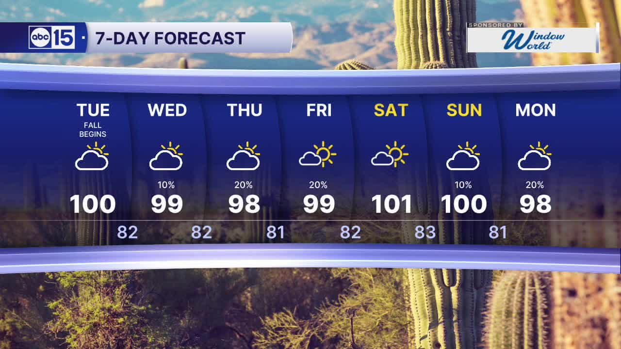
Temperatures will climb into the upper 90s to low 100s each afternoon, putting highs near to slightly above normal in the Valley.
Mornings will stay comfortable, with lows dropping into the upper 70s to low 80s each day.
Moisture shifts farther west on Wednesday, bringing our best Valley storm chance of the week at 20 percent.
Storm chances stay higher across northern and eastern Arizona on Thursday and Friday, with Valley chances dropping those days as well.
Drier air moves in Saturday, pushing highs back to the triple digits.
Moisture from Hurricane Polo could reach Arizona as early as the weekend, too!
Stay tuned for updates as we get closer.


2026 Sky Harbor Rainfall to-date: 2.07" (-3.16" from average)
2026 Monsoon Rainfall to-date: 1.75" (-0.56" from average)
__________________________________________
Daily rainfall reports from all across the Valley can be found here.
__________________________________________
PHOENIX IS GETTING DRIER - LOWER RAINFALL AVERAGES NOW
Average Monsoon Rainfall in Phoenix (1981-2010): 2.71" of rain
NEW Average Monsoon Rainfall in Phoenix (1991-2020): 2.43" of rain
Average Yearly Rainfall in Phoenix (1981-2010): 8:03" of rain
NEW Average Yearly Rainfall in Phoenix (1991-2020): 7.22" of rain
__________________________________________
Share your weather photos and videos with us anytime: share@abc15.com.
______________________________________
