



PHOENIX — Moisture is moving into Arizona as an upper-level low passes by, already bringing a few showers during the day and even some rain to the Valley Sunday night.
As outflow boundaries shift toward the Rim, rain will become more widespread across the Mogollon Rim and White Mountains overnight and into Monday morning.
The low will continue moving through Monday, boosting rain chances again along the I-40 corridor, the Rim, and eastern Arizona. An initial round of rain moved through early in the day, with another round of scattered showers and thunderstorms expected to develop by the afternoon and expand in coverage into the evening.
If you have outdoor plans in the High Country, plan for periods of showers and thunderstorms.
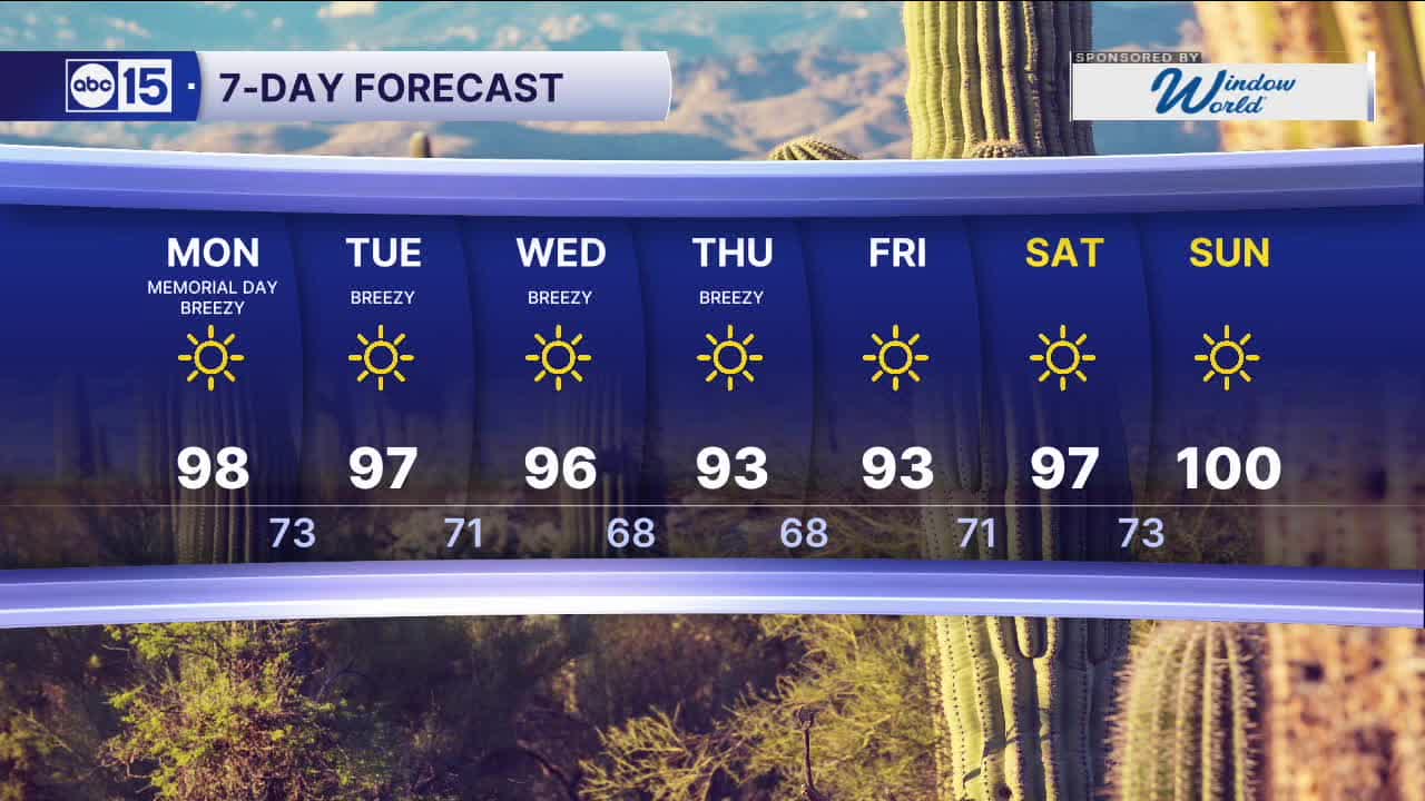
In the Valley, skies will clear with highs climbing into the upper 90s, making for a near-seasonal day.
Winds will stay elevated into the new week, peaking on Wednesday and Thursday as another low-pressure system moves into the region from the northeast.
Gusts in the Valley could reach 25 to 30 mph, with stronger gusts over 40 mph possible across the High Country.


2026 Sky Harbor Official Rainfall to date: 0.32" (-2.57" from average)
__________________________________________
Daily rainfall reports from all across the Valley can be found here.
__________________________________________
PHOENIX IS GETTING DRIER - LOWER RAINFALL AVERAGES NOW
Average Monsoon Rainfall in Phoenix (1981-2010): 2.71" of rain
NEW Average Monsoon Rainfall in Phoenix (1991-2020): 2.43" of rain
Average Yearly Rainfall in Phoenix (1981-2010): 8:03" of rain
NEW Average Yearly Rainfall in Phoenix (1991-2020): 7.22" of rain
__________________________________________
Share your weather photos and videos with us anytime: share@abc15.com.
______________________________________
