

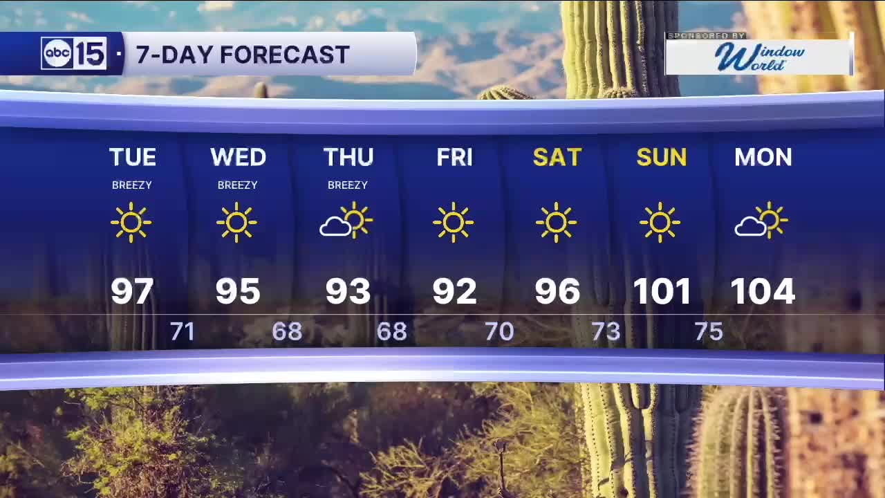


PHOENIX — After a stormy day across parts of Arizona, this system is moving out, with drier conditions returning by Tuesday. Another storm, however, is set to move in midweek, bringing stronger winds and a drop in temperatures.
Tuesday will be mostly sunny in the Valley, with morning lows in the lower 70s and afternoon highs climbing into the mid to upper 90s.
Winds will remain breezy and peak on Wednesday and Thursday as the next system moves in from the northwest. Gusts in the Valley could reach 25 to 30 mph, with stronger gusts over 40 mph possible across the High Country.
A Wind Advisory goes into effect Tuesday for the Colorado River Valley, where gusts up to 50 mph are possible near Lake Mohave. Boaters should use caution, and drivers should be prepared for areas of blowing dust.
That same system will also bring a cooldown later this week, with highs falling slightly below average, topping out in the low to mid 90s.


2026 Sky Harbor Official Rainfall to date: 0.32" (-2.58" from average)
__________________________________________
Daily rainfall reports from all across the Valley can be found here.
__________________________________________
PHOENIX IS GETTING DRIER - LOWER RAINFALL AVERAGES NOW
Average Monsoon Rainfall in Phoenix (1981-2010): 2.71" of rain
NEW Average Monsoon Rainfall in Phoenix (1991-2020): 2.43" of rain
Average Yearly Rainfall in Phoenix (1981-2010): 8:03" of rain
NEW Average Yearly Rainfall in Phoenix (1991-2020): 7.22" of rain
__________________________________________
Share your weather photos and videos with us anytime: share@abc15.com.
______________________________________
