

PHOENIX — A storm system is tracking through Arizona bringing rain, snow and cooler air.
Here in the Valley, there's a chance of few light showers overnight with less than a tenth of an inch of rain expected.
Up north, the snow level will fall to around 6,000 to 6,500 feet which may bring a light dusting of snow into Flagstaff and other spots along the Mogollon Rim by early Tuesday morning.
Winds are picking up and ushering in some much cooler air with this storm system, too.
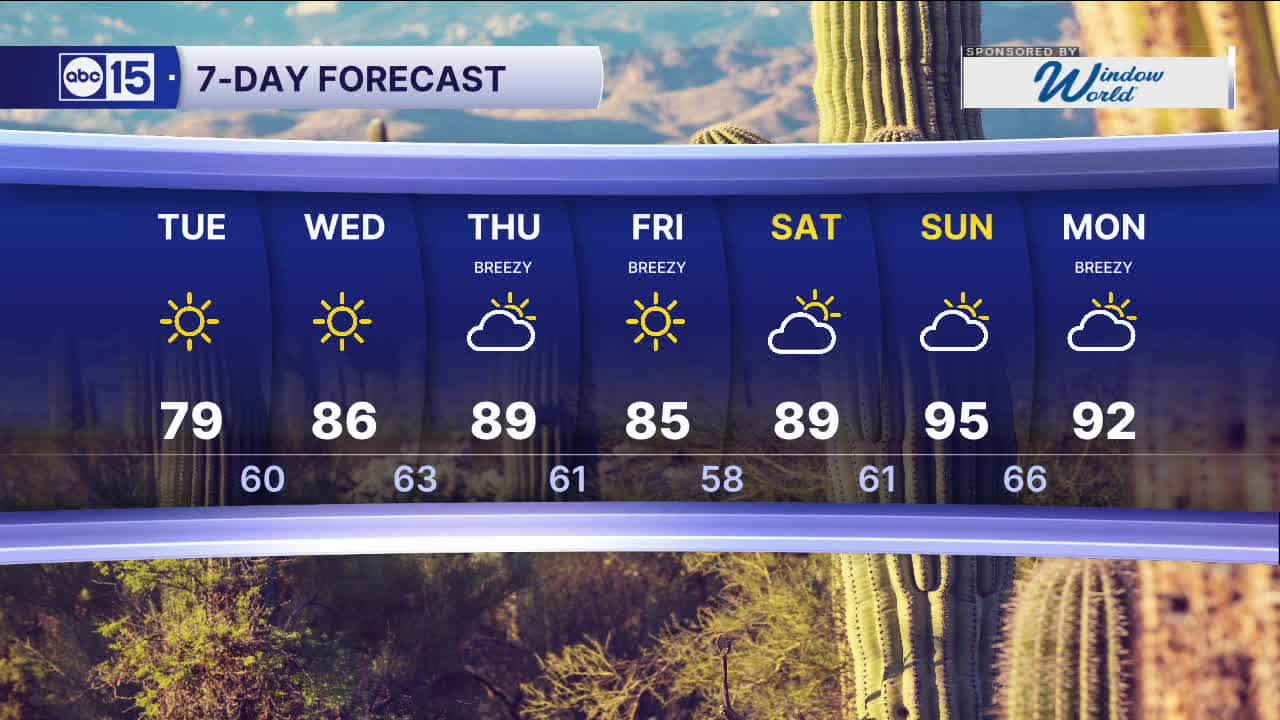
Valley temperatures will drop into the 70s on Tuesday before rebounding to the upper 80s by Thursday.
Another storm system will pass to our north on Thursday, picking up winds and dropping temperatures a few degrees on Friday.
Then, it's back to the 90s by the end of next weekend.


2026 Sky Harbor Official Rainfall to date: 0.32" (-2.41" from average)
__________________________________________
Daily rainfall reports from all across the Valley can be found here.
__________________________________________
PHOENIX IS GETTING DRIER - LOWER RAINFALL AVERAGES NOW
Average Monsoon Rainfall in Phoenix (1981-2010): 2.71" of rain
NEW Average Monsoon Rainfall in Phoenix (1991-2020): 2.43" of rain
Average Yearly Rainfall in Phoenix (1981-2010): 8:03" of rain
NEW Average Yearly Rainfall in Phoenix (1991-2020): 7.22" of rain
__________________________________________
Share your weather photos and videos with us anytime: share@abc15.com.
______________________________________
