

PHOENIX — A weak storm system moved through Arizona on Monday, bringing cloudy skies, more wind and even a few light rain showers to parts of our state.
Breezy to windy conditions have been picking up lots of dust over the past couple of days and that is impacting air quality.
A No Burn Day has been issued for Maricopa County. This means burning wood in fireplaces, stoves, or outdoor fire pits is prohibited. Leaf blowers and off-road vehicle use is discouraged too.
If you have any respiratory issues, like asthma, bronchitis or COPD, you may want to limit your time outside or you could have difficulty breathing.
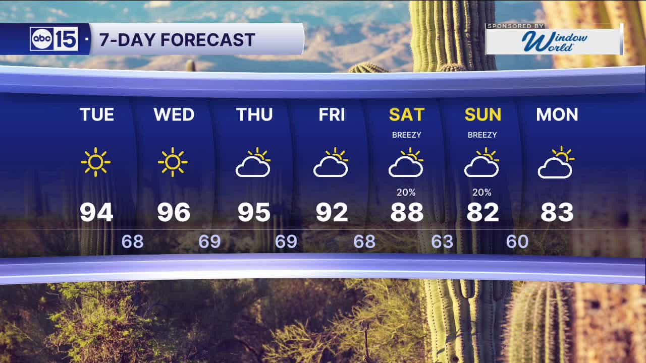
Once this storm system clears out on Tuesday, high pressure will build back in. Skies will start to clear out and temperatures will rebound into the mid 90s.
Expect sunny skies through the middle of the week as temperatures run around 10 degrees above normal.
Another storm system will move in over the weekend, bringing cooler air and more rain chances to parts of Arizona.
Expect temperatures back in the 80s in Phoenix on Saturday and Sunday as breezes pick up again.


2026 Sky Harbor Official Rainfall to date: 0.32" (-2.33" from average)
__________________________________________
Daily rainfall reports from all across the Valley can be found here.
__________________________________________
PHOENIX IS GETTING DRIER - LOWER RAINFALL AVERAGES NOW
Average Monsoon Rainfall in Phoenix (1981-2010): 2.71" of rain
NEW Average Monsoon Rainfall in Phoenix (1991-2020): 2.43" of rain
Average Yearly Rainfall in Phoenix (1981-2010): 8:03" of rain
NEW Average Yearly Rainfall in Phoenix (1991-2020): 7.22" of rain
__________________________________________
Share your weather photos and videos with us anytime: share@abc15.com.
______________________________________
