

PHOENIX — We’re cranking up the heat again across Arizona!
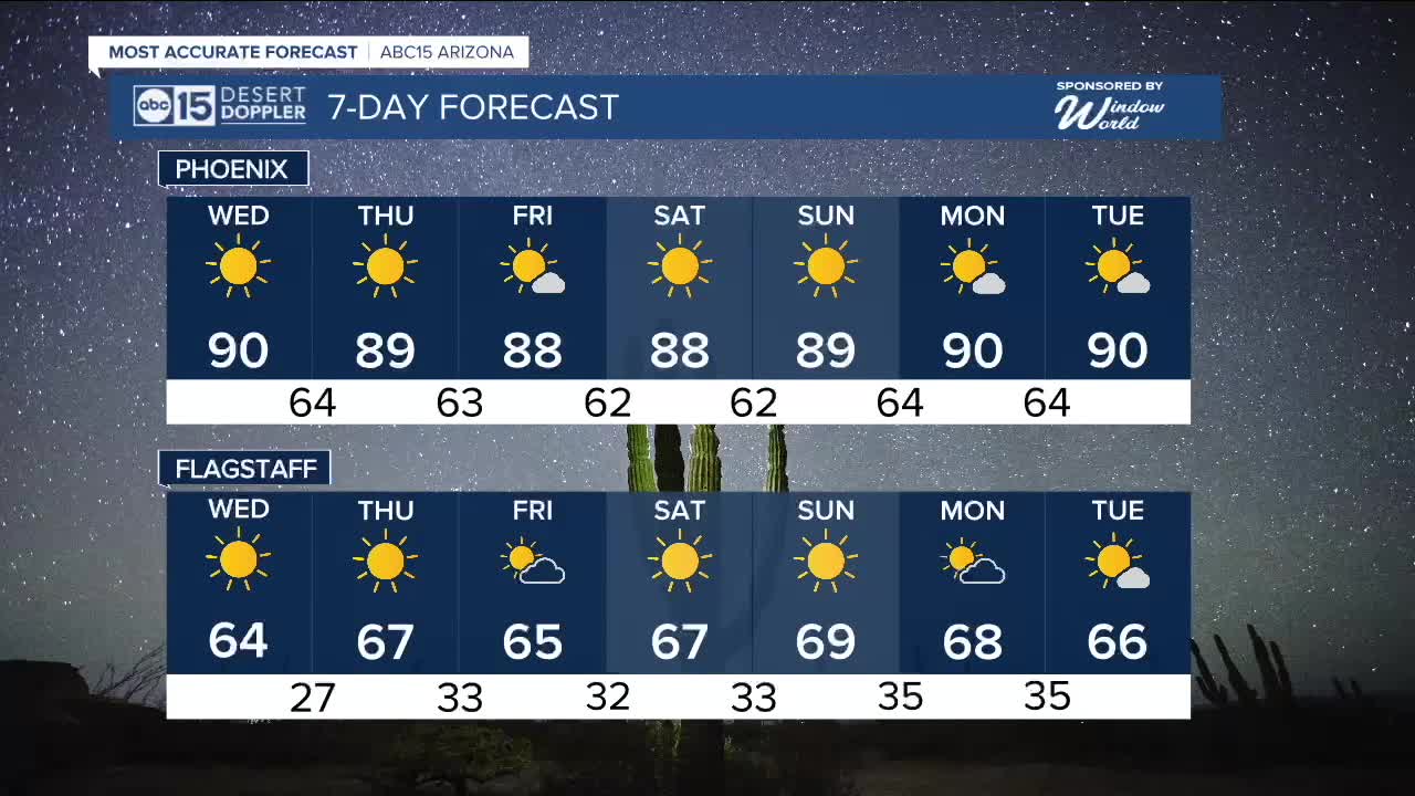
High pressure is building in, sending Valley temperatures back into the low 90s through the middle of the week.
On average, Phoenix sees its last 90-degree day around October 30th, but we have hit the 90s as late as mid November before back in 2020.
While high pressure will dominate our forecast over the next week, we are also tracking a weak disturbance on Wednesday that will pick up winds and drop temperatures a few degrees heading into Halloween.
Wind Advisories have been issued for areas just east of Phoenix from 5 am until noon on Wednesday. Downslope wind gusts could hit 45 mph in places like Apache Junction, Gold Canyon, Fountain Hills, East Mesa, Mazatzal Mountains, Pinal and Superstition Mountains, Rio Verde, Salt River, and Superior.
Across the rest of the Phoenix metro area, peak wind gusts will top out at 20 to 30 mph on Wednesday as high temperatures reach 90 degrees in many neighborhoods.
We will drop back into the upper 80s on Thursday, Friday, Saturday and Sunday as our forecast stays mostly sunny and dry.
That slight cool-down will put trick-or-treating temperatures in the mid 70s to low 80s on Halloween night in the Valley.
Then, as high pressure intensifies over the Southwest, Phoenix will be back in the 90s early next week.


2025 Sky Harbor Official Rainfall to date: 7.49" (+1.63" from average)
Monsoon 2025 Sky Harbor Official Rainfall: 2.76" (+0.33" from average)
__________________________________________
Daily rainfall reports from all across the Valley can be found here.
__________________________________________
PHOENIX IS GETTING DRIER - LOWER RAINFALL AVERAGES NOW
Average Monsoon Rainfall in Phoenix (1981-2010): 2.71" of rain
NEW Average Monsoon Rainfall in Phoenix (1991-2020): 2.43" of rain
Average Yearly Rainfall in Phoenix (1981-2010): 8:03" of rain
NEW Average Yearly Rainfall in Phoenix (1991-2020): 7.22" of rain
__________________________________________
Share your weather photos and videos with us anytime: share@abc15.com.
______________________________________
