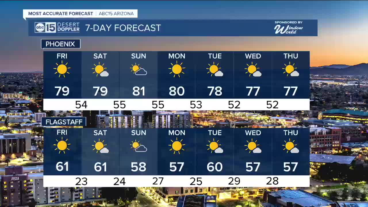


PHOENIX — High pressure is dominating our forecast, bringing unseasonably warm weather to Arizona this week.
Valley temperatures will top out in the upper 70s and low 80s for the next several days, which is around 10 to 15 degrees above normal for this time of year.
Friday’s high of 79 degrees in Phoenix could tie the record set in 2010.
By Sunday and Monday, Phoenix could climb into the low 80 degrees, which would also be record-breaking for those days.
Overnight lows will drop into the upper 40s to mid 50s across the Valley, which is several degrees above normal as well.
Over the weekend, a few clouds will move through, but our forecast will stay dry.
In fact, the long-term outlook over the next few weeks favors warm and dry conditions as we head toward Christmas.


2025 Sky Harbor Official Rainfall to date: 8.28" (+1.55" from average)
Monsoon 2025 Sky Harbor Official Rainfall: 2.76" (+0.33" from average)
__________________________________________
Daily rainfall reports from all across the Valley can be found here.
__________________________________________
PHOENIX IS GETTING DRIER - LOWER RAINFALL AVERAGES NOW
Average Monsoon Rainfall in Phoenix (1981-2010): 2.71" of rain
NEW Average Monsoon Rainfall in Phoenix (1991-2020): 2.43" of rain
Average Yearly Rainfall in Phoenix (1981-2010): 8:03" of rain
NEW Average Yearly Rainfall in Phoenix (1991-2020): 7.22" of rain
__________________________________________
Share your weather photos and videos with us anytime: share@abc15.com.
______________________________________
