

PHOENIX — Our sizzling March heatwave continues.
Phoenix has already seen 8 days in a row in the triple digits. Prior to this year, we had only hit 100 degrees once in the month of March since records began in the late 1800s.
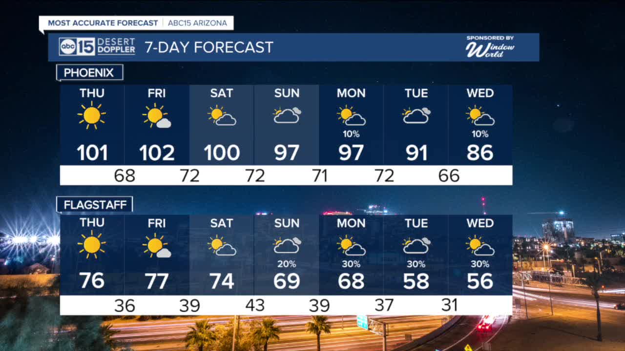
But, we won't stop there. Triple digits are in the forecast for the rest of the week with daily heat records likely broken every day.
Limit your time outside during the heat of the day and make sure to stay hydrated as temperatures continue to run around 20 degrees above normal for this time of year.
Over the weekend, the big ridge of high pressure that's been locked in place over the Southwest will start to shift east. This will allow moisture to stream in from the south, a set-up we typically only see during the monsoon.
That increased moisture could lead to shower and thunderstorm development over the higher terrain Saturday and Sunday.
Then, a storm system will approach from the northwest bringing even higher rain chances next week as temperatures start to drop.
Valley temperatures will drop into the 90s for the start of next week and we may even see highs in the 80s as early as Wednesday.


2026 Sky Harbor Official Rainfall to date: 0.31" (-2.16" from average)
__________________________________________
Daily rainfall reports from all across the Valley can be found here.
__________________________________________
PHOENIX IS GETTING DRIER - LOWER RAINFALL AVERAGES NOW
Average Monsoon Rainfall in Phoenix (1981-2010): 2.71" of rain
NEW Average Monsoon Rainfall in Phoenix (1991-2020): 2.43" of rain
Average Yearly Rainfall in Phoenix (1981-2010): 8:03" of rain
NEW Average Yearly Rainfall in Phoenix (1991-2020): 7.22" of rain
__________________________________________
Share your weather photos and videos with us anytime: share@abc15.com.
______________________________________
