



PHOENIX — The monsoon is back in action across Arizona!
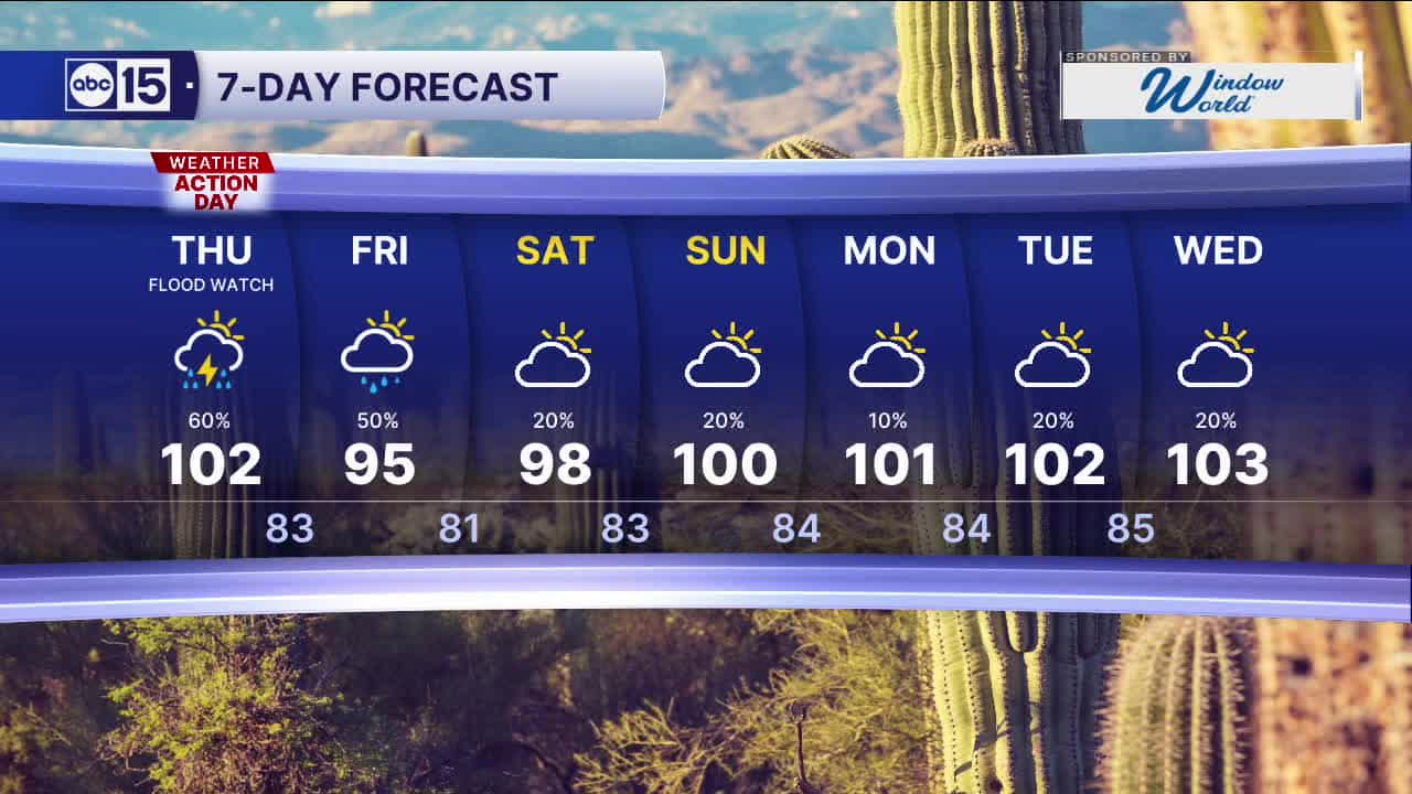
The National Weather Service has issued a Flood Watch for central and southern Arizona on Thursday with the potential for storms that drop 2 to 3 inches of rain per hour!
With that potential for heavy rain and flooding, Thursday will be an ABC15 Weather Action Day. Take action now to prepare for possible storms here in the Valley, especially on Thursday evening. If you are in a flood-prone area or located near/downstream of a wildfire burn scar, have sandbags in place.
The Flood Watch will be in effect until 5 a.m. on Friday.
Storm chances will continue through the weekend, but right now the biggest impact looks to be Thursday night.


2026 Sky Harbor Official Rainfall to date: 0.70" (-2.57" from average)
Monsoon 2026 Sky Harbor Official Rainfall to date: 0.38" (+0.03" from average)
__________________________________________
Daily rainfall reports from all across the Valley can be found here.
__________________________________________
PHOENIX IS GETTING DRIER - LOWER RAINFALL AVERAGES NOW
Average Monsoon Rainfall in Phoenix (1981-2010): 2.71" of rain
NEW Average Monsoon Rainfall in Phoenix (1991-2020): 2.43" of rain
Average Yearly Rainfall in Phoenix (1981-2010): 8:03" of rain
NEW Average Yearly Rainfall in Phoenix (1991-2020): 7.22" of rain
__________________________________________
Share your weather photos and videos with us anytime: share@abc15.com.
______________________________________
