

PHOENIX — It's been a hot week so far in the Valley!
High pressure is now slowly moving east as low pressure approaches from the southwest, so temperatures are gradually dropping.
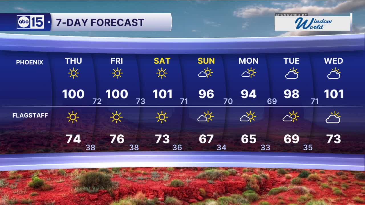
Phoenix will top out in the low 100s for the rest of the week with overnight lows in the low 70s.
We could drop out of the triple digits over the weekend as a storm system passes to our north.
Expect Valley highs down near the seasonal average of 95 degrees by Sunday.
We're also tracking an Ozone High Pollution Watch on Friday. So plan on limiting your time outside if you have any respiratory issues like asthma, bronchitis or COPD.
Exposure to ozone can increase the number and severity of asthma attacks, cause or aggravate bronchitis or other lung disease, and reduce the body's ability to fight infection. Symptoms may include itchy eyes, nose, and throat, wheezing, coughing, shortness of breath, chest pain, and upper respiratory issues.
Please help reduce ozone pollution by driving as little as possible, carpooling or using public transit. Even waiting to refuel your vehicle until after dark and avoiding idling in long drive-thru lines helps too.


2026 Sky Harbor Official Rainfall to date: 0.32" (-2.52" from average)
__________________________________________
Daily rainfall reports from all across the Valley can be found here.
__________________________________________
PHOENIX IS GETTING DRIER - LOWER RAINFALL AVERAGES NOW
Average Monsoon Rainfall in Phoenix (1981-2010): 2.71" of rain
NEW Average Monsoon Rainfall in Phoenix (1991-2020): 2.43" of rain
Average Yearly Rainfall in Phoenix (1981-2010): 8:03" of rain
NEW Average Yearly Rainfall in Phoenix (1991-2020): 7.22" of rain
__________________________________________
Share your weather photos and videos with us anytime: share@abc15.com.
______________________________________
