



PHOENIX — Storm chances are ramping up this week across Arizona!
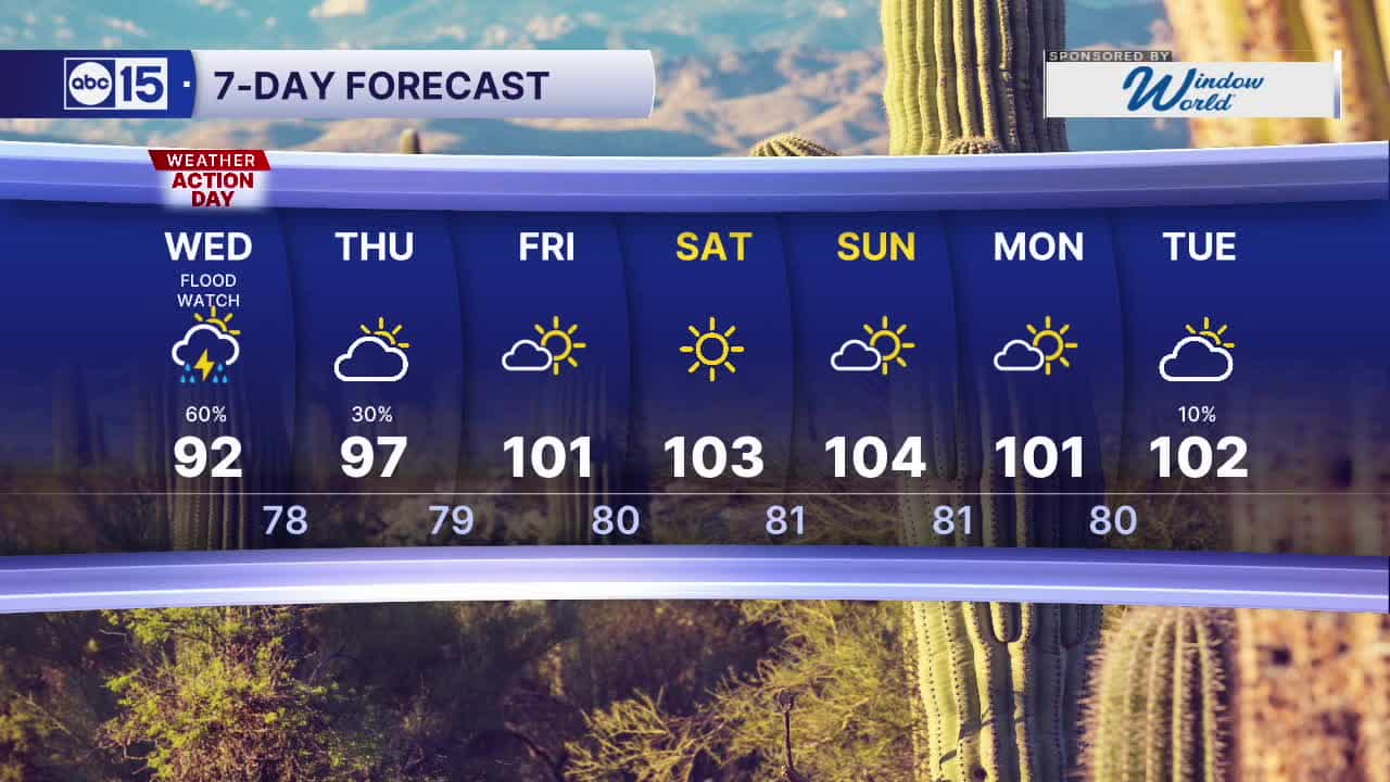
Wednesday is now an ABC15 Weather Action Day with a Flood Watch in effect through 11 p.m. across the entire Phoenix metro area as well as most of the state.
Any storms that move through will be capable of producing heavy rain and flooding, so stay weather-aware and do not drive through flooded roadways or washes.
We could also see storms that bring damaging winds over 60 mph, dangerous cloud-to-ground lightning, hail and blowing dust.
Temperatures will take a dive, too.
Valley highs will only reach the 90s on Wednesday and Thursday, putting us several degrees below normal for this time of year. Overnight lows will drop into the 70s to low 80s.
Drier air begins to push in on Friday. That will clear out our Valley storm chances through the weekend as temperatures warm back into the triple digits.


2026 Sky Harbor Rainfall to-date: 1.73" (-3.39" from average)
2026 Monsoon Rainfall to-date: 1.41" (-0.79" from average)
__________________________________________
Daily rainfall reports from all across the Valley can be found here.
__________________________________________
PHOENIX IS GETTING DRIER - LOWER RAINFALL AVERAGES NOW
Average Monsoon Rainfall in Phoenix (1981-2010): 2.71" of rain
NEW Average Monsoon Rainfall in Phoenix (1991-2020): 2.43" of rain
Average Yearly Rainfall in Phoenix (1981-2010): 8:03" of rain
NEW Average Yearly Rainfall in Phoenix (1991-2020): 7.22" of rain
__________________________________________
Share your weather photos and videos with us anytime: share@abc15.com.
______________________________________
