



PHOENIX — The rain is moving out of the Valley!
A tropical system soaked parts of central Arizona over the past 24 hours. One to three inches of rain fell from Apache Junction and east Mesa through Fountain Hills and north Scottsdale to Anthem and New River. That led to running washes and plenty of street flooding.
Some washes and flood control channels could keep flowing this morning. Stay weather-aware and do not drive through flooded roadways or washes.
Any lingering showers will clear out this morning.
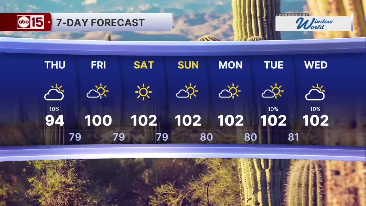
Temperatures stay slightly below normal today with Valley highs reaching the mid-90s. Highs climb to around 100 degrees on Friday, but it will still feel a bit muggy.
Much drier air arrives this weekend.
Expect plenty of sunshine with highs slightly above 100 degrees through early next week. Mornings will finally feel more comfortable, with lows dropping into the 70s.
A low pressure system early next week could bring moisture and a slight chance of rain back to Arizona by Tuesday. Stay tuned as we get closer.


2026 Sky Harbor Rainfall to-date: 2.09" (-3.05" from average)
2026 Monsoon Rainfall to-date: 1.77" (-0.45" from average)
__________________________________________
Daily rainfall reports from all across the Valley can be found here.
__________________________________________
PHOENIX IS GETTING DRIER - LOWER RAINFALL AVERAGES NOW
Average Monsoon Rainfall in Phoenix (1981-2010): 2.71" of rain
NEW Average Monsoon Rainfall in Phoenix (1991-2020): 2.43" of rain
Average Yearly Rainfall in Phoenix (1981-2010): 8:03" of rain
NEW Average Yearly Rainfall in Phoenix (1991-2020): 7.22" of rain
__________________________________________
Share your weather photos and videos with us anytime: share@abc15.com.
______________________________________
