



PHOENIX — Monsoon storms slammed parts of the Valley again Thursday evening and there's still a very slight chance for more on Friday before we dry back out.
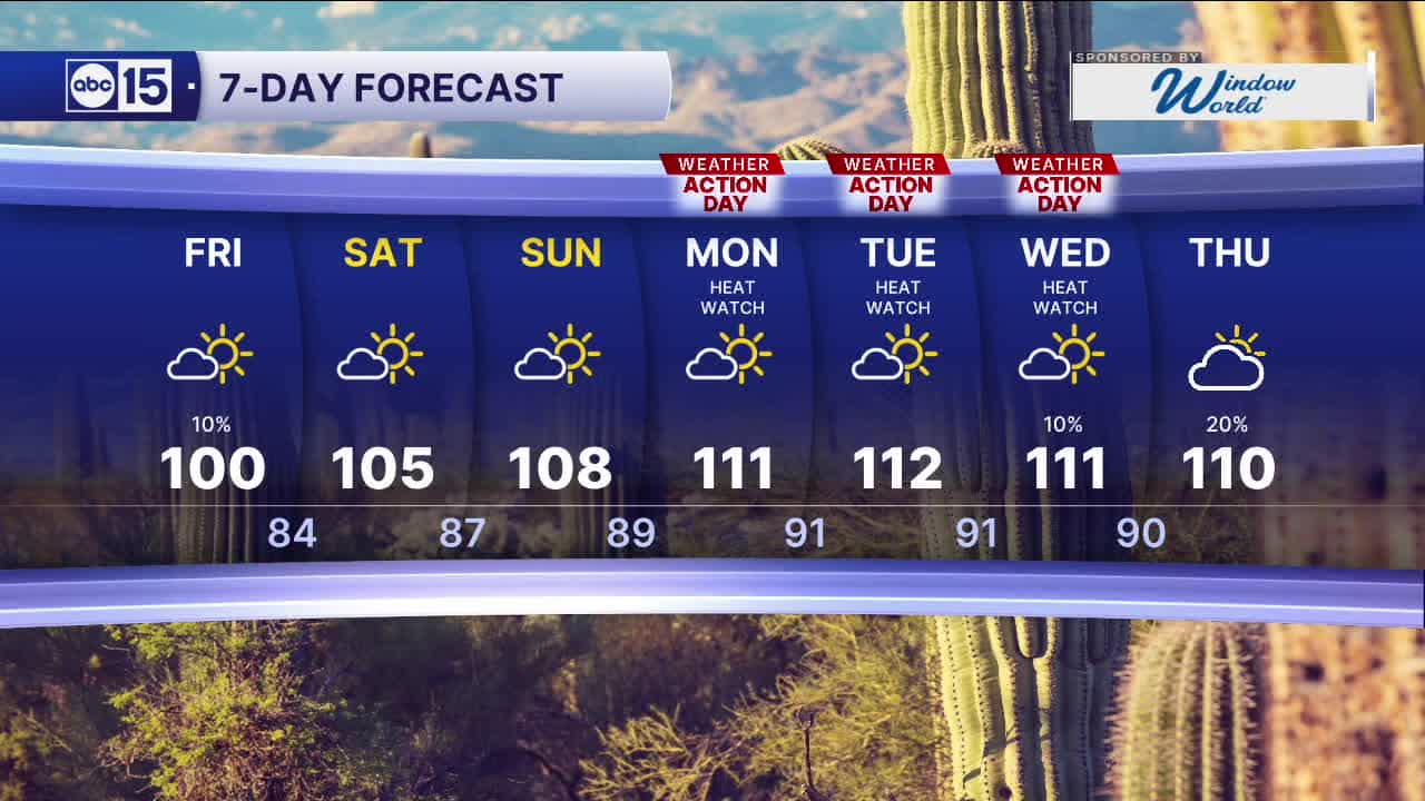
Temperatures will stay a few degrees below normal with highs near 100 degrees in the Valley on Friday.
As our forecast dries back out over the weekend, temperatures will start to soar.
An Extreme Heat Watch is in effect Monday through Wednesday across the Valley as temperatures approach 112 degrees.
So, those three days will be ABC15 Weather Action Days as a reminder to take action to protect yourself, you family and your pets from these dangerously hot temperatures.
Make sure to stay hydrated and limit your time outside from 11 a.m. to 6 p.m. when temperatures are at their hottest. Bring your pets inside during these times, too.
If you need to be outside, wear lightweight, light-colored clothing and take frequent breaks in shade or air conditioning to cool down.


2026 Sky Harbor Rainfall to-date: 0.97" (-3.28" from average)
2026 Monsoon Rainfall to-date: 0.65" (-0.68" from average)
__________________________________________
Daily rainfall reports from all across the Valley can be found here.
__________________________________________
PHOENIX IS GETTING DRIER - LOWER RAINFALL AVERAGES NOW
Average Monsoon Rainfall in Phoenix (1981-2010): 2.71" of rain
NEW Average Monsoon Rainfall in Phoenix (1991-2020): 2.43" of rain
Average Yearly Rainfall in Phoenix (1981-2010): 8:03" of rain
NEW Average Yearly Rainfall in Phoenix (1991-2020): 7.22" of rain
__________________________________________
Share your weather photos and videos with us anytime: share@abc15.com.
______________________________________
