

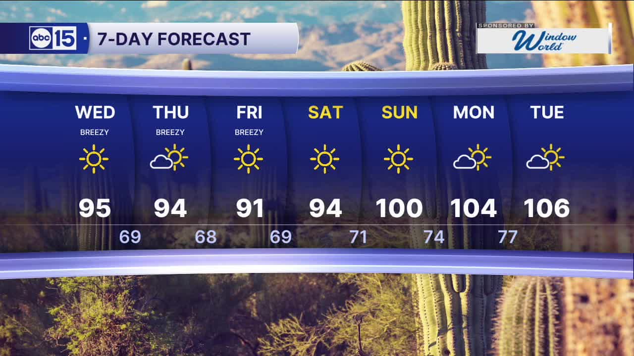


PHOENIX — An area of low pressure is digging down across the West Coast and is set to bring us cooler air for the late week, along with some gusty winds.
A Wind Advisory is now in effect through Wednesday morning for the Colorado River Valley, where gusts up to 50 mph are possible near Lake Mohave. Boaters should use caution. Drivers should be ready for areas of blowing dust.
Winds stay breezy and peak on Wednesday as that system arrives from the northwest. Gusts in the Valley could reach 25 to 30 mph. Stronger gusts over 40 mph are possible across the high country.
High winds and low humidity will elevate fire danger across northern Arizona. Red Flag Warnings go into effect on Wednesday for portions of Coconino, Navajo, and Apache counties. Outdoor burning is strongly discouraged.
For the Valley, Tuesday will start out in the lower 70s and some upper 60s outside the city. By the afternoon, highs climb to the mid 90s.
Temperatures continue to fall through Friday. By then, we could see highs in the Valley in the upper 80s and lower 90s—well below average for late May.
The cool down is short-lived, as high pressure returns, sending temperatures well into the triple digits by next week.


2026 Sky Harbor Official Rainfall to date: 0.32" (-2.58" from average)
__________________________________________
Daily rainfall reports from all across the Valley can be found here.
__________________________________________
PHOENIX IS GETTING DRIER - LOWER RAINFALL AVERAGES NOW
Average Monsoon Rainfall in Phoenix (1981-2010): 2.71" of rain
NEW Average Monsoon Rainfall in Phoenix (1991-2020): 2.43" of rain
Average Yearly Rainfall in Phoenix (1981-2010): 8:03" of rain
NEW Average Yearly Rainfall in Phoenix (1991-2020): 7.22" of rain
__________________________________________
Share your weather photos and videos with us anytime: share@abc15.com.
______________________________________
