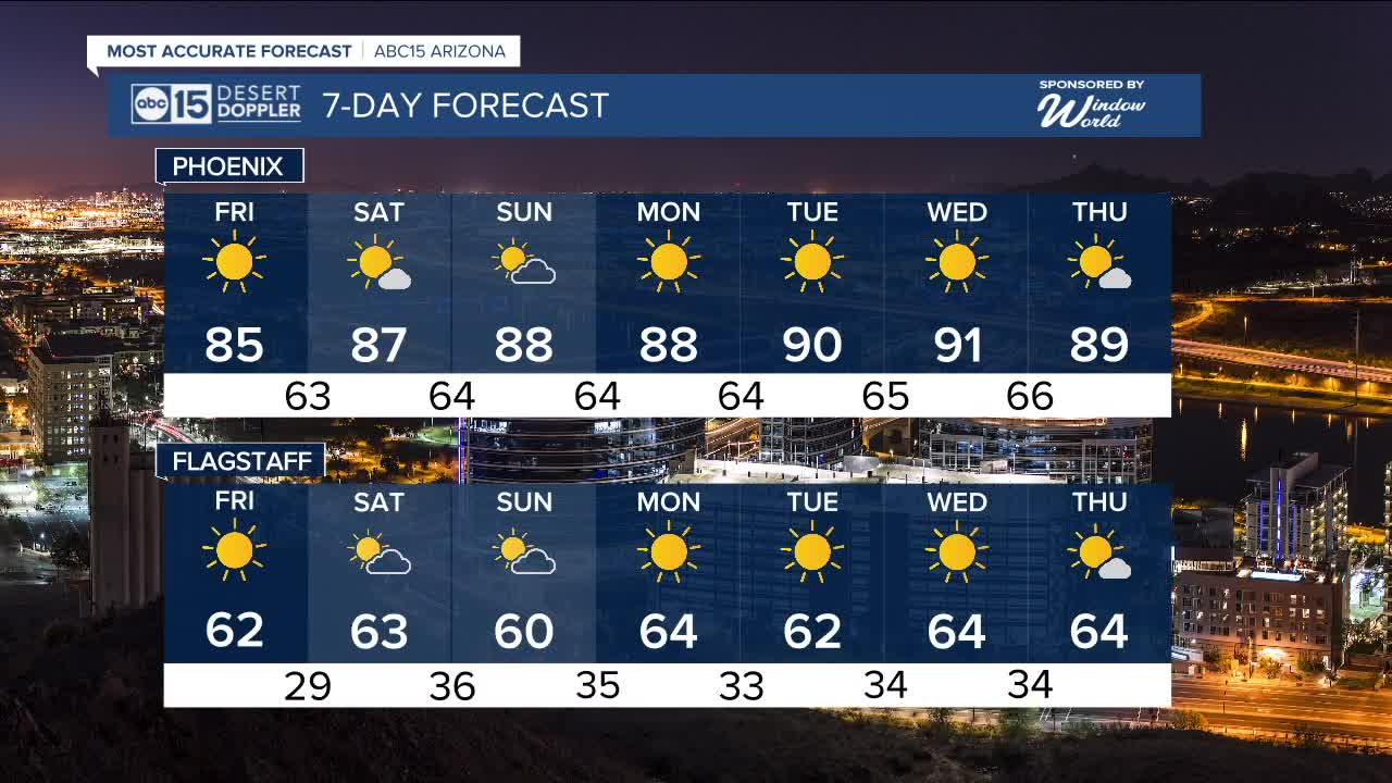


PHOENIX — It's a nice end to the week in the Valley!
Our latest cool-down has brought temperatures down into the low to mid 80s and we'll stay there on Friday, too.
High pressure will build in again over the weekend and early next week, sending temperatures back into the low 90s by Tuesday and Wednesday.
On average, Phoenix sees its last 90-degree day around October 30th, but we’ve had 90s as late as mid-November back in 2020.
We are expecting another drop just in time for Halloween. Right now, it looks like highs will be in the mid to upper 80s with Trick-or-treating temperatures in the 70s on Halloween night.


2025 Sky Harbor Official Rainfall to date: 7.49" (+1.72" from average)
Monsoon 2025 Sky Harbor Official Rainfall: 2.76" (+0.33" from average)
__________________________________________
Daily rainfall reports from all across the Valley can be found here.
__________________________________________
PHOENIX IS GETTING DRIER - LOWER RAINFALL AVERAGES NOW
Average Monsoon Rainfall in Phoenix (1981-2010): 2.71" of rain
NEW Average Monsoon Rainfall in Phoenix (1991-2020): 2.43" of rain
Average Yearly Rainfall in Phoenix (1981-2010): 8:03" of rain
NEW Average Yearly Rainfall in Phoenix (1991-2020): 7.22" of rain
__________________________________________
Share your weather photos and videos with us anytime: share@abc15.com.
______________________________________
