

TONTO NATIONAL FOREST, AZ — With triple-digit heat and bone-dry conditions gripping Arizona, a new technology is being quietly deployed inside the forest that feeds Phoenix's water supply.
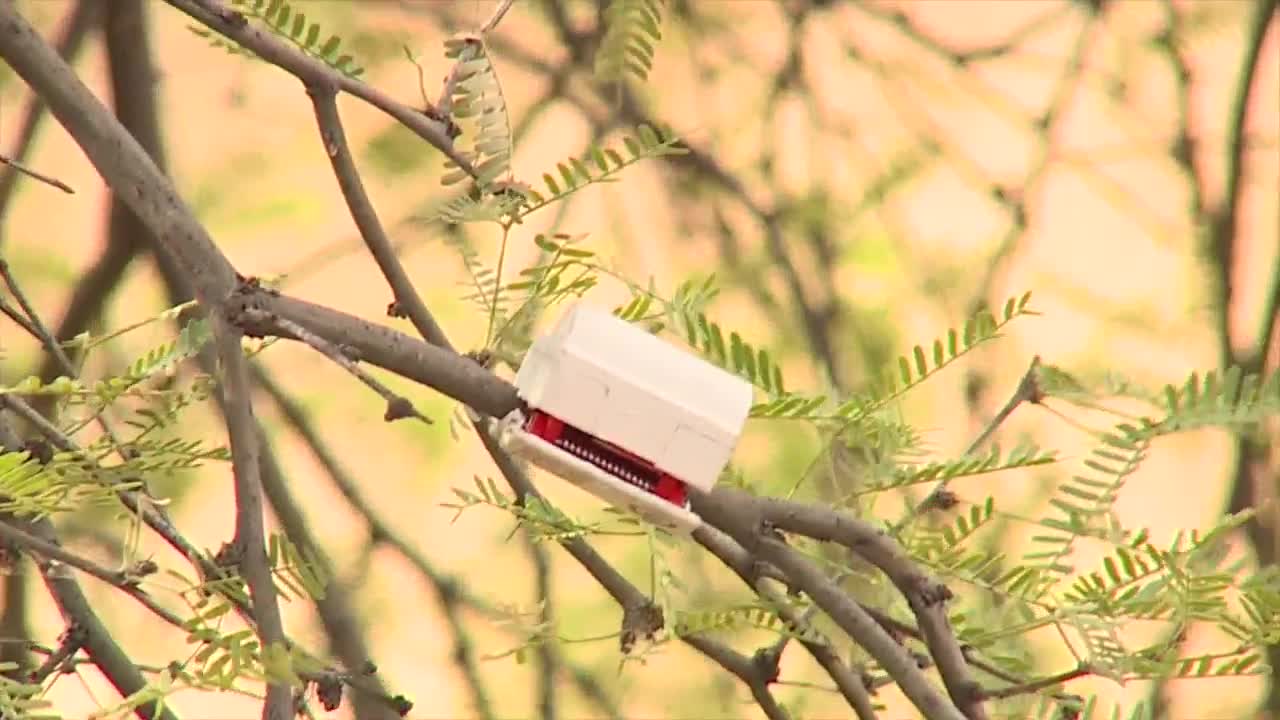
The Salt River Project, Northern Arizona University, and a tech company called Growvera are installing 112 sensors across six sites in the Tonto National Forest.
The sensors measure three things: how dry dead vegetation is, how dry living plants are, and how dry the soil is at three different depths.
That data paints a complete picture of how easily a fire could ignite and how fast it could spread.
"This is really important for fire risk, to give us an idea of when a fire burns, how hot it's going to burn, how tall the flames will be, and the risk posed to different communities, infrastructure, that sort of thing," said Asher May, a product engineer with Growvera.
The Tonto National Forest sits inside SRP's watershed. When wildfires burn through it, they damage the land that collects and stores water for more than two million Valley residents.

Do you have a concern in your community or a news tip? We want to hear from you!
Connect with us: share@abc15.com
The threat is not theoretical. The Sycamore Fire burning near Globe sat just five miles from one of SRP's high-voltage transmission lines.
"We want to try to keep the power on," said Barry Johnson, SRP's wildfire mitigation specialist. "We want to keep everybody's AC cool this time of year and the refrigerators on."
The sensors track soil and vegetation moisture 24 hours a day. Getting that kind of data used to require sending crews into the forest by hand, sometimes only once a week.
Now, it is continuous.
NAU researcher Salli Dymond says that matters even after a fire has already started.
"Not only can we get this in advance of a wildfire sparking, but we can also get it on the fire front, so you can get an idea of how even the winds from the fire, the smoke from the fire, the temperature is changing the conditions on the ground," Dymond said.
The pilot is funded by SRP's Innovation and Development Program and is expected to run for at least one year. It is the first installation of this technology in Arizona.
If results hold, researchers say the sensor network could scale to other forests across the state, including the Coconino and the Apache-Sitgreaves.
The long-term goal is a statewide web of real-time fuel moisture data that land managers and fire weather forecasters can access long before a spark ever hits the ground.
Want more news in your community? Add ABC15 as a preferred source on Google below:
![]()

