

PHOENIX — Phoenix hit the 80s for the first time this year!
Our high on Wednesday soared to a record-tying 81 degrees at Sky Harbor.
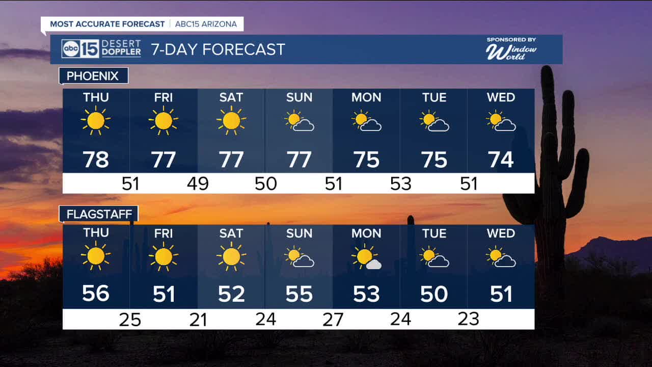
More 80s are not out of the question this week, but right now forecast models are showing most of the Valley in the upper 70s for the next several days, putting us around 10 degrees above normal for this time of year.
Thursday's record is also 81 degrees in Phoenix, set in 2000.
Expect overnight temperatures in the Valley in the mid 40s to low 50s for the rest of the week.
We may feel a few breezes in the Valley, but the windier conditions will stay confined to northern and northwestern Arizona this week. Watch out for wind gusts near 40 mph in Bullhead City!
We'll also see a few passing clouds at times, but our forecast will stay dry through the weekend and into early next week.


2026 Sky Harbor Official Rainfall to date: 0.18" (-0.24" from average)
_________________________________________
2025 Sky Harbor Official Rainfall: 8.31" (+1.09" from average)
Monsoon 2025 Sky Harbor Official Rainfall: 2.76" (+0.33" from average)
_________________________________________
Daily rainfall reports from all across the Valley can be found here.
__________________________________________
PHOENIX IS GETTING DRIER - LOWER RAINFALL AVERAGES NOW
Average Monsoon Rainfall in Phoenix (1981-2010): 2.71" of rain
NEW Average Monsoon Rainfall in Phoenix (1991-2020): 2.43" of rain
Average Yearly Rainfall in Phoenix (1981-2010): 8:03" of rain
NEW Average Yearly Rainfall in Phoenix (1991-2020): 7.22" of rain
__________________________________________
Share your weather photos and videos with us anytime: share@abc15.com.
______________________________________
