

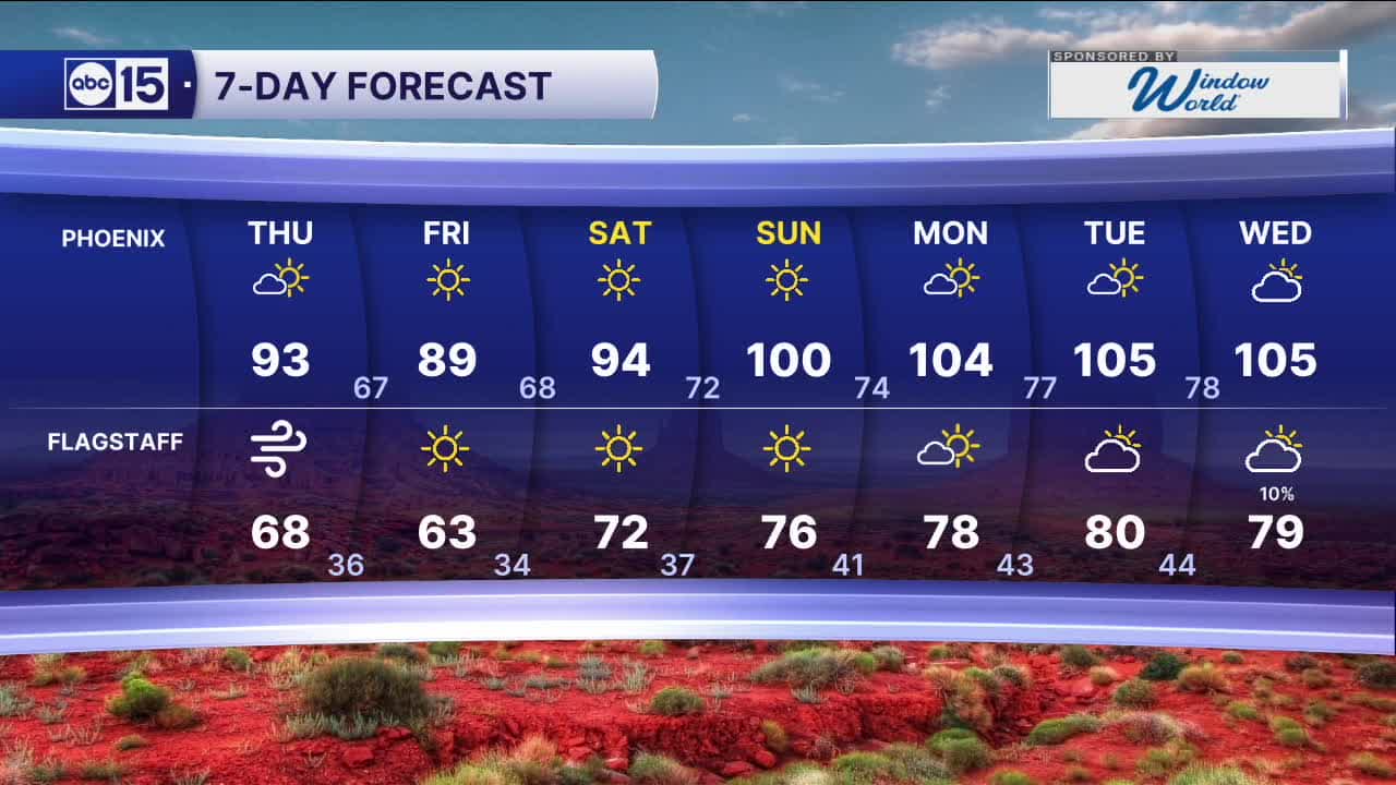


PHOENIX — Winds are picking up and temperatures are dropping as a storm system approaches from the west.
Peak wind gusts could hit 25 to 30 mph in the Valley again on Thursday with gusts closer to 40 mph across parts of northern Arizona.
High winds and dry air will lead to more fire danger across northern Arizona on Thursday, too.
Another round of Red Flag Warnings are in effect for parts of Coconino, Navajo, and Apache counties from 11 a.m. until 8 p.m.
Outdoor burning is strongly discouraged. Do not flick cigarettes out the window and make sure nothing is dragging from your vehicle that could cause a spark.
Breezes will continue into Friday across much of the state as cooler air moves in.
Valley temperatures will fall into the upper 80s Friday, which is around 10 degrees below average for late May.
Our Valley forecast looks to stay dry, but we could see a few spotty showers across northern Arizona on Friday as this latest storm system starts to move out.
Then, high pressure returns over the weekend sending temperatures into the triple digits by Sunday.


2026 Sky Harbor Official Rainfall to date: 0.32" (-2.59" from average)
__________________________________________
Daily rainfall reports from all across the Valley can be found here.
__________________________________________
PHOENIX IS GETTING DRIER - LOWER RAINFALL AVERAGES NOW
Average Monsoon Rainfall in Phoenix (1981-2010): 2.71" of rain
NEW Average Monsoon Rainfall in Phoenix (1991-2020): 2.43" of rain
Average Yearly Rainfall in Phoenix (1981-2010): 8:03" of rain
NEW Average Yearly Rainfall in Phoenix (1991-2020): 7.22" of rain
__________________________________________
Share your weather photos and videos with us anytime: share@abc15.com.
______________________________________
