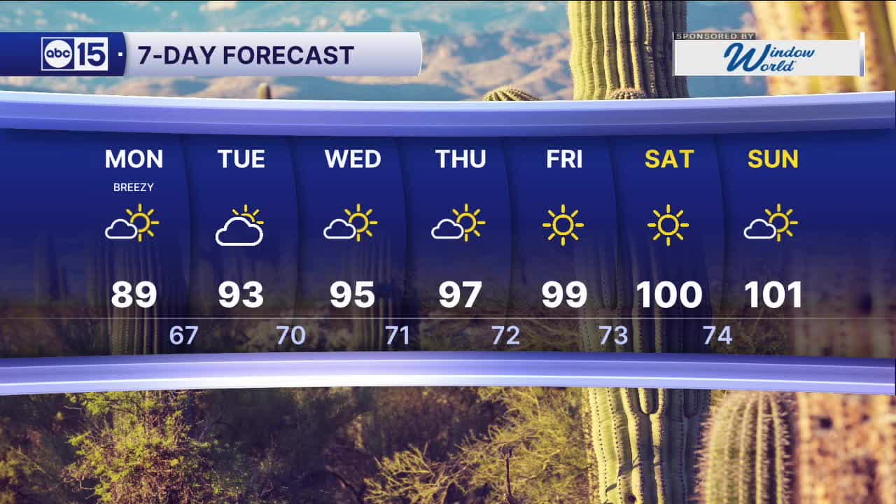


PHOENIX — A cold front will sweep across Arizona overnight, bringing a few showers to the northern parts of the state. Behind it, winds will stay elevated, and temperatures will drop to start the week.
In northwestern Arizona, a High Wind Warning remains in effect through Monday morning for Mohave County. Gusts could reach 50 to 60 mph, creating hazardous travel—especially for high-profile vehicles—and areas of blowing dust.
A Wind Advisory is also in place for much of northern Arizona, where gusts of 45 to 50 mph are expected into early Monday.
Winds will ease slightly on Monday, but breezy conditions will continue in the Valley with gusts between 20 and 25 mph.
Temperatures will take a noticeable dip. Morning lows in the Valley will fall into the upper 60s, with afternoon highs only reaching the upper 80s—more than five degrees below normal.
As this system exits, another will settle to our southeast and linger through the week. As it weakens, temperatures will gradually climb, returning to the 90s and potentially reaching triple digits by next weekend.


2026 Sky Harbor Official Rainfall to date: 0.32" (-2.54" from average)
_________________________________________
Daily rainfall reports from all across the Valley can be found here.
__________________________________________
PHOENIX IS GETTING DRIER - LOWER RAINFALL AVERAGES NOW
Average Monsoon Rainfall in Phoenix (1981-2010): 2.71" of rain
NEW Average Monsoon Rainfall in Phoenix (1991-2020): 2.43" of rain
Average Yearly Rainfall in Phoenix (1981-2010): 8:03" of rain
NEW Average Yearly Rainfall in Phoenix (1991-2020): 7.22" of rain
__________________________________________
Share your weather photos and videos with us anytime: share@abc15.com.
______________________________________
