



PHOENIX — After a hot end to the weekend with a high near 98 degrees, big changes are on the way as a storm system moves in from the West Coast.
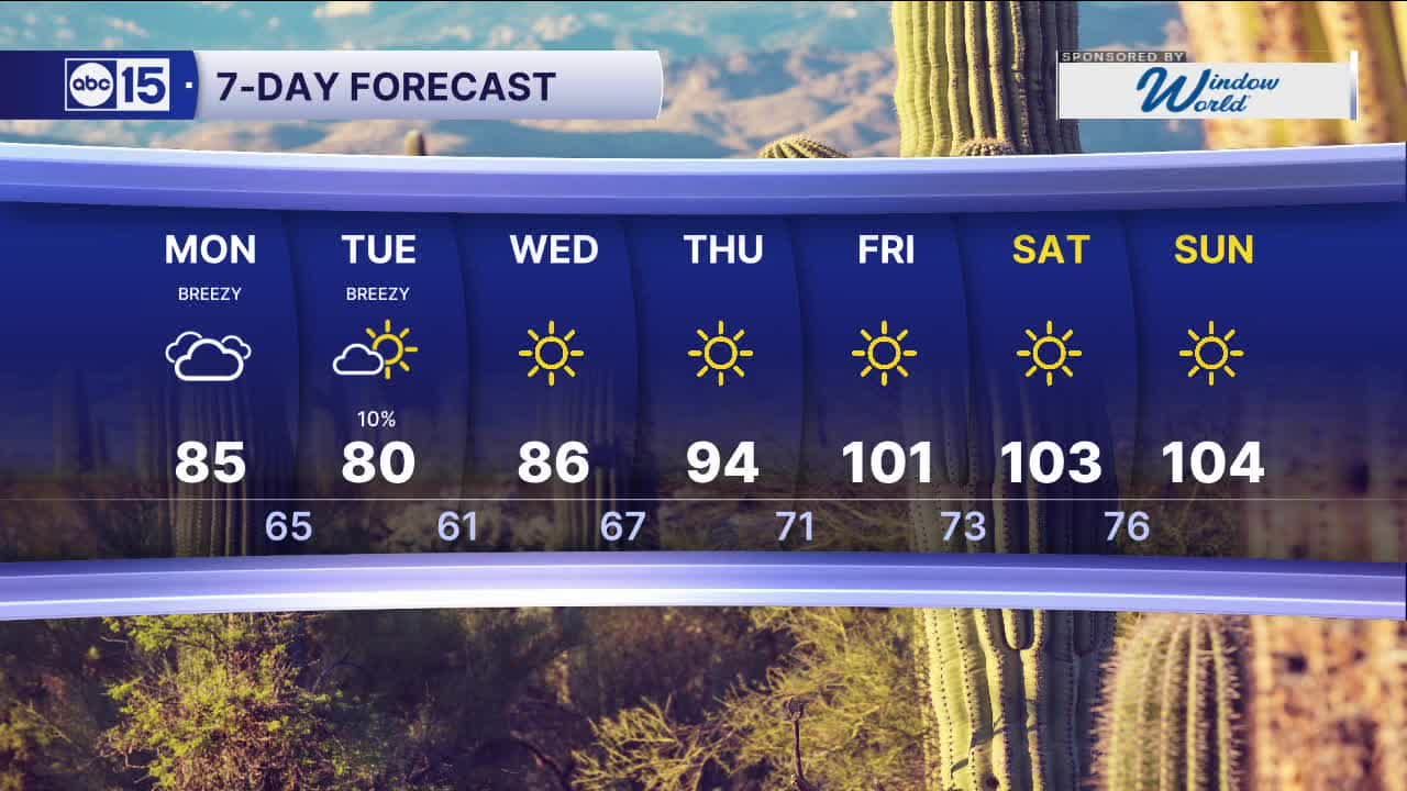
Temperatures will drop nearly 20 degrees by Tuesday as that system pushes through the region.
For Monday, expect mostly cloudy skies, with rain chances increasing late in the evening into the overnight hours for parts of southeastern Arizona.
In the Valley, a brief shower can’t be ruled out early Tuesday morning, but chances remain low at around 10 percent.
Farther north, scattered showers and storms will develop across the Rim and northeastern Arizona through Tuesday afternoon.
As the system moves through, winds will stay breezy at times, with Valley gusts still around 20 miles per hour.
That cooler air will knock highs back to around 80 degrees on Tuesday, with morning lows dipping into the upper 50s to lower 60s.
But that cool-down won’t last long. A strong ridge of high pressure builds in behind the storm, sending temperatures right back into the triple digits by late week and into next weekend.


2026 Sky Harbor Official Rainfall to date: 0.32" (-2.48" from average)
__________________________________________
Daily rainfall reports from all across the Valley can be found here.
__________________________________________
PHOENIX IS GETTING DRIER - LOWER RAINFALL AVERAGES NOW
Average Monsoon Rainfall in Phoenix (1981-2010): 2.71" of rain
NEW Average Monsoon Rainfall in Phoenix (1991-2020): 2.43" of rain
Average Yearly Rainfall in Phoenix (1981-2010): 8:03" of rain
NEW Average Yearly Rainfall in Phoenix (1991-2020): 7.22" of rain
__________________________________________
Share your weather photos and videos with us anytime: share@abc15.com.
______________________________________
