



PHOENIX — After a week of extreme heat, temperatures are finally trending down as storm chances go up.
Monsoon storms are possible through the weekend, especially across northern, eastern and southeastern Arizona.
While the Valley rain threat looks lower on Sunday, storms in our surrounding areas could still send gusty winds or blowing dust towards the Phoenix Metro, so stay weather-aware.
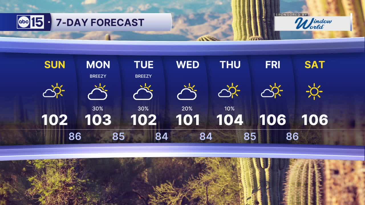
Temperatures will drop closer to the averages for this time of year, with highs near 102 through the weekend.
Temperatures could fall even further this week as storm chances ramp up again.
We could see more widespread storms around Arizona and here in the Valley Monday, Tuesday and Wednesday.
Storms will be capable of producing strong winds, heavy rain and flooding so stay weather-aware and so stay tuned for updates as we get closer.


2026 Sky Harbor Rainfall to-date: 1.73" (-3.32" from average)
2026 Monsoon Rainfall to-date: 1.41" (-0.70" from average)
__________________________________________
Daily rainfall reports from all across the Valley can be found here.
__________________________________________
PHOENIX IS GETTING DRIER - LOWER RAINFALL AVERAGES NOW
Average Monsoon Rainfall in Phoenix (1981-2010): 2.71" of rain
NEW Average Monsoon Rainfall in Phoenix (1991-2020): 2.43" of rain
Average Yearly Rainfall in Phoenix (1981-2010): 8:03" of rain
NEW Average Yearly Rainfall in Phoenix (1991-2020): 7.22" of rain
__________________________________________
Share your weather photos and videos with us anytime: share@abc15.com.
______________________________________
