

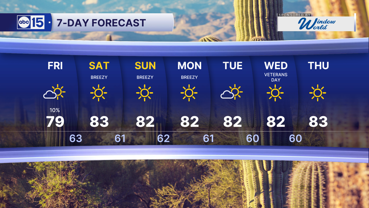


PHOENIX — We are tracking a weak storm system passing through on Friday. It could bring scattered showers and a few thunderstorms to the Valley, the high country and southeastern Arizona.
Valley rain chances peak near 10% Friday evening.
Breezes will pick up this weekend, with gusts of 20 to 35 mph along and south of the Mogollon Rim on Saturday. Valley breezes stay lighter.
A Lake Wind Advisory is in effect for Lake Havasu and Lake Mohave from 5 a.m. Friday until 5 p.m. Saturday. North winds of 15 to 25 mph with gusts up to 40 mph could create waves of 1 to 3 feet. Conditions will be hazardous for small boats, and high-profile vehicles should use extra caution.
As high pressure builds in over the weekend, temperatures will climb back into the low 80s here in the Valley.
Flood Warnings remain in effect for some rivers and creeks across Arizona as dam releases and runoff continue. This includes the Verde, Salt and Gila Rivers through the greater Phoenix area.
Flooding along the Salt and Gila Rivers could last through at least the weekend as SRP continues releasing water from dams upstream.
So, stay out of our local rivers and do not attempt to cross any flooded roadways.


2026 Sky Harbor Official Rainfall to date: 5.01" (-1.00" from average)
Monsoon 2026 Sky Harbor Official Rainfall: 2.46" (+0.03" from average)
__________________________________________
Daily rainfall reports from all across the Valley can be found here.
__________________________________________
PHOENIX IS GETTING DRIER - LOWER RAINFALL AVERAGES NOW
Average Monsoon Rainfall in Phoenix (1981-2010): 2.71" of rain
NEW Average Monsoon Rainfall in Phoenix (1991-2020): 2.43" of rain
Average Yearly Rainfall in Phoenix (1981-2010): 8:03" of rain
NEW Average Yearly Rainfall in Phoenix (1991-2020): 7.22" of rain
__________________________________________
Share your weather photos and videos with us anytime: share@abc15.com.
______________________________________
