

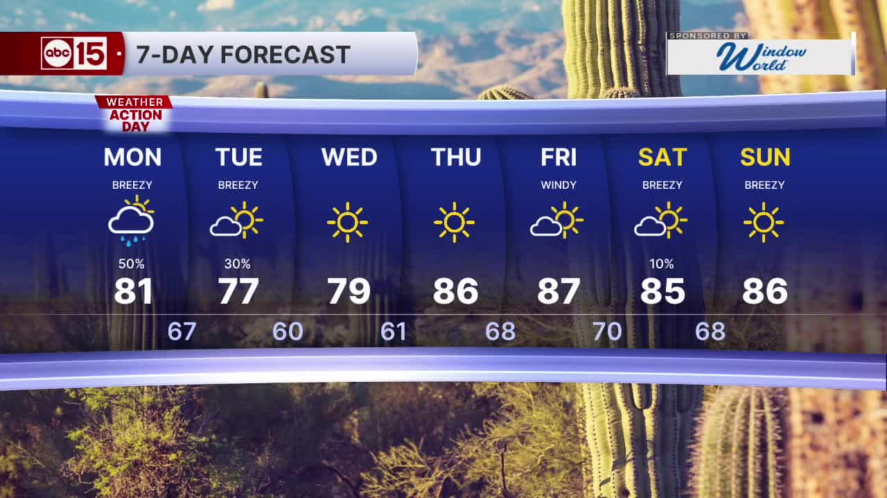


PHOENIX — Wind, rain and a major cool-down is coming to Arizona as moisture from the remnants of Tropical Storm Rachel lingers and another fall storm system moves in.
Monday is an ABC15 Weather Action Day as a reminder to take action to stay safe in when storms develop.
We could still see several more rounds of showers and thunderstorms across the state, including here in the Valley on Monday and early Tuesday.
Parts of the Valley could end up with as much as an additional quarter of an inch of rain through Tuesday.
Flash flooding will still be possible in creeks, normally dry washes, swimming holes, and over recently burned areas. Low-water crossings may be flooded, so do not attempt to drive through them.
Winds will pick up across the rest of the state again on Monday, with Valley wind gusts as high as 30 to 35 mph.
As this fall storm system moves across northern Arizona, we're also going to get a big drop in temperatures!
Valley highs will fall into the mid 80s on Monday and then cool into the 70s by through the middle of the week.


2026 Sky Harbor Official Rainfall to date: 3.08" (-2.49" from average)
Monsoon 2026 Sky Harbor Official Rainfall: 2.46" (+0.03" from average)
__________________________________________
Daily rainfall reports from all across the Valley can be found here.
__________________________________________
PHOENIX IS GETTING DRIER - LOWER RAINFALL AVERAGES NOW
Average Monsoon Rainfall in Phoenix (1981-2010): 2.71" of rain
NEW Average Monsoon Rainfall in Phoenix (1991-2020): 2.43" of rain
Average Yearly Rainfall in Phoenix (1981-2010): 8:03" of rain
NEW Average Yearly Rainfall in Phoenix (1991-2020): 7.22" of rain
__________________________________________
Share your weather photos and videos with us anytime: share@abc15.com.
______________________________________
