

PHOENIX — It's another cold night across Arizona.
Freeze Warnings are in effect for Punkin Center, Miami, Globe, Peridot, Sunflower and San Carlos from 2 a.m. until 9 a.m. on Friday.
In these areas, remember to “Protect the P’s”: people, pets, plants, and pipes.
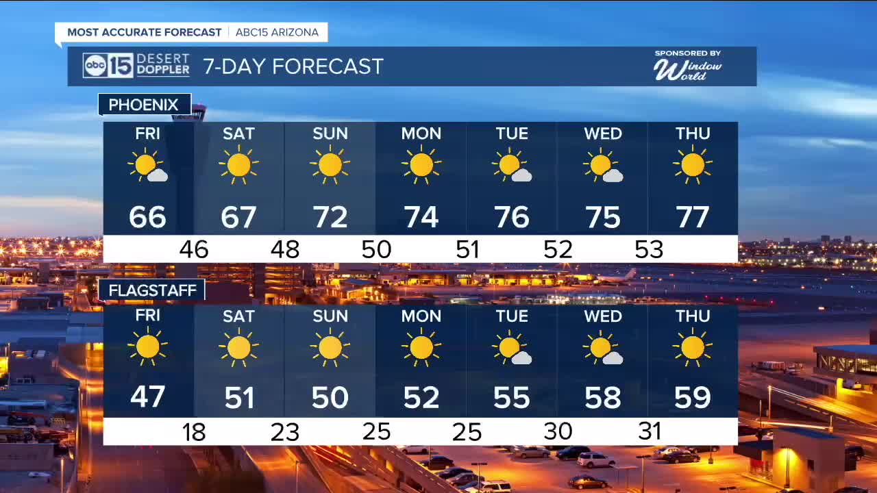
Across the high country, temperatures will fall into the teens and twenties, so bundle up!
Temperatures will begin to rebound Friday afternoon with afternoon highs in the mid 60s here in the Valley and mid to upper 40s along the Mogollon Rim.
As high pressure returns this weekend and early next week, our forecast will stay dry and temperatures will continue to climb.
Afternoon highs will be back in the 70s here in the Valley starting Sunday and we'll climb into the mid to upper 70s by the middle of next week.


2025 Sky Harbor Official Rainfall to date: 8.28" (+1.71" from average)
Monsoon 2025 Sky Harbor Official Rainfall: 2.76" (+0.33" from average)
__________________________________________
Daily rainfall reports from all across the Valley can be found here.
__________________________________________
PHOENIX IS GETTING DRIER - LOWER RAINFALL AVERAGES NOW
Average Monsoon Rainfall in Phoenix (1981-2010): 2.71" of rain
NEW Average Monsoon Rainfall in Phoenix (1991-2020): 2.43" of rain
Average Yearly Rainfall in Phoenix (1981-2010): 8:03" of rain
NEW Average Yearly Rainfall in Phoenix (1991-2020): 7.22" of rain
__________________________________________
Share your weather photos and videos with us anytime: share@abc15.com.
______________________________________
