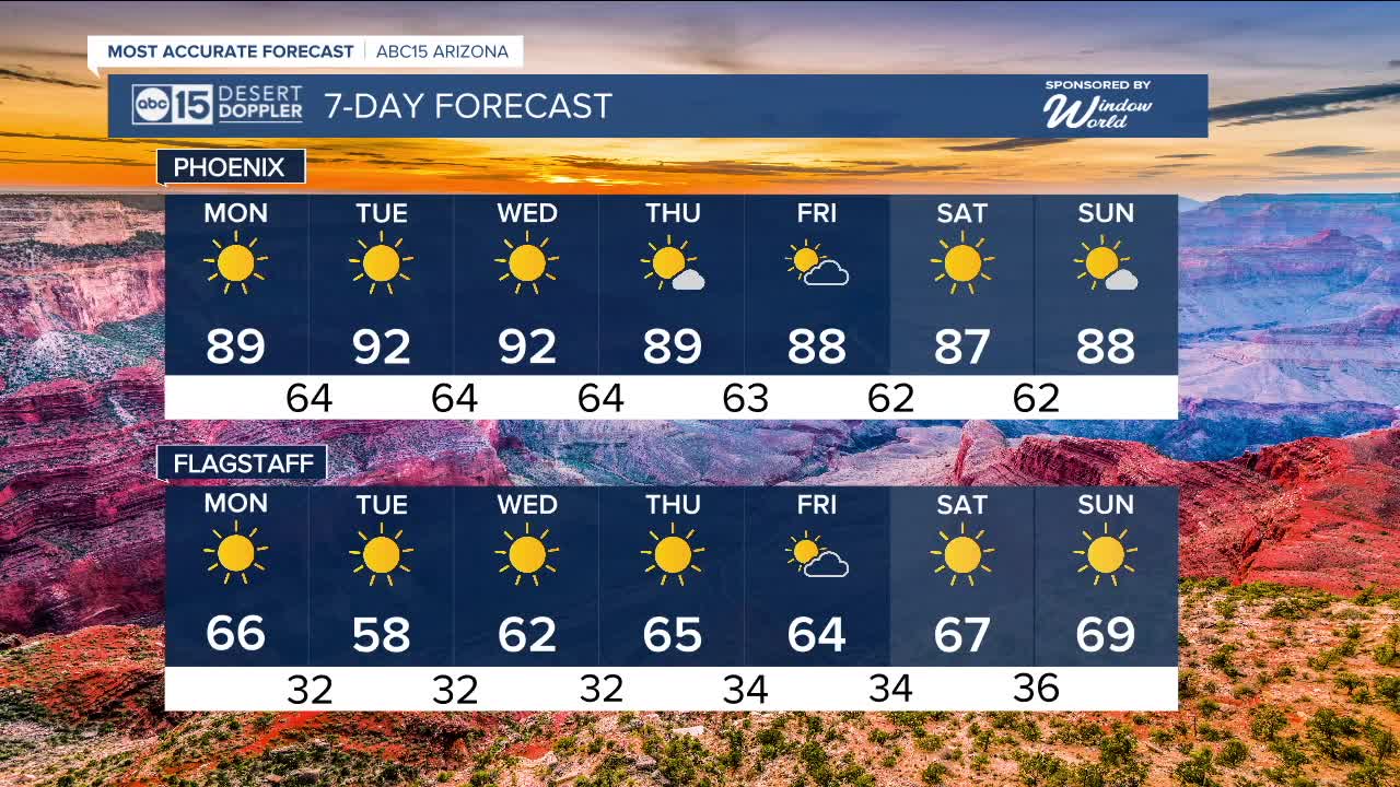


PHOENIX — Temperatures are heating up once again across Arizona!
High pressure building in sent highs back into the 90s on Sunday, and we are likely to top out in the 90s again by Tuesday and Wednesday.
Typically, Phoenix’s last 90-degree day falls around October 30th, though we've seen 90s as late as mid-November, like in 2020.
This ridge of high pressure will keep us abnormally dry and abnormally warm in the afternoon; however, morning lows will still be in the mid to lower 60s.
A slight drop in temperatures is in store just in time for Halloween. It looks like highs will be in the mid to upper 80s, with trick-or-treating temps in the 70s.


_________________________________________
2025 Sky Harbor Official Rainfall to date: 7.49" (+1.67" from average)
Monsoon 2025 Sky Harbor Official Rainfall: 2.76" (+0.33" from average)
__________________________________________
Daily rainfall reports from all across the Valley can be found here.
__________________________________________
PHOENIX IS GETTING DRIER - LOWER RAINFALL AVERAGES NOW
Average Monsoon Rainfall in Phoenix (1981-2010): 2.71" of rain
NEW Average Monsoon Rainfall in Phoenix (1991-2020): 2.43" of rain
Average Yearly Rainfall in Phoenix (1981-2010): 8:03" of rain
NEW Average Yearly Rainfall in Phoenix (1991-2020): 7.22" of rain
__________________________________________
Share your weather photos and videos with us anytime: share@abc15.com.
______________________________________
