

PHOENIX — It's been a warm start to the week, but cooler air is on the way!
Clouds are moving in and there's a slight chance of a few light showers in parts of our state overnight ahead of our next storm.
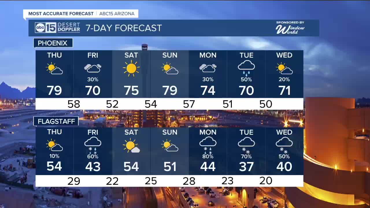
Cooler air will move in on Friday as that storm system approaches from the west. That could bring more rain and snow showers to parts of the state, too.
The snow level will be around 7,000 feet in elevation, so only the highest elevations will get any.
Here in the Valley, rain chances begin early Friday morning and last through much of the day. Some neighborhoods could get up to a tenth of an inch of rain.
High pressure will briefly return over the weekend, drying things out and warming us back into the upper 70s by Sunday.
Then, a stronger storm system will move in from the west early next week. That one could bring more measurable rain to the Valley and snow to areas over 6,000 feet in elevation.
We'll keep you posted on this one as we get closer.


2026 Sky Harbor Official Rainfall to date: 0.18" (-0.98" from average)
_________________________________________
2025 Sky Harbor Official Rainfall: 8.31" (+1.09" from average)
Monsoon 2025 Sky Harbor Official Rainfall: 2.76" (+0.33" from average)
__________________________________________
Daily rainfall reports from all across the Valley can be found here.
__________________________________________
PHOENIX IS GETTING DRIER - LOWER RAINFALL AVERAGES NOW
Average Monsoon Rainfall in Phoenix (1981-2010): 2.71" of rain
NEW Average Monsoon Rainfall in Phoenix (1991-2020): 2.43" of rain
Average Yearly Rainfall in Phoenix (1981-2010): 8:03" of rain
NEW Average Yearly Rainfall in Phoenix (1991-2020): 7.22" of rain
__________________________________________
Share your weather photos and videos with us anytime: share@abc15.com.
______________________________________
