

PHOENIX — Monsoon season is here and it's making quite the entrance in State 48!
Parts of the Valley and central Arizona are already seeing scattered showers and storms this morning.
More are on the way.
Afternoon storms will fire near and along the Mogollon Rim. Outflow boundaries from those storms could push toward the Valley by late afternoon and early evening. If they make it to the metro, expect additional storms to develop.
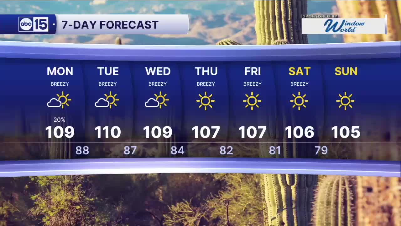
The heat isn't going anywhere either. Highs will flirt with 110 degrees today, which is nearly five degrees above average for mid-June.
A drier pattern returns mid-week, however. Temperatures hold near 110 through Wednesday before dropping back closer to normal by the end of the week.


2026 Sky Harbor Official Rainfall to date: 0.32" (-2.60" from average)
Monsoon 2026 Sky Harbor Official Rainfall to date: 0.00" (0.00" from average)
__________________________________________
Daily rainfall reports from all across the Valley can be found here.
__________________________________________
PHOENIX IS GETTING DRIER - LOWER RAINFALL AVERAGES NOW
Average Monsoon Rainfall in Phoenix (1981-2010): 2.71" of rain
NEW Average Monsoon Rainfall in Phoenix (1991-2020): 2.43" of rain
Average Yearly Rainfall in Phoenix (1981-2010): 8:03" of rain
NEW Average Yearly Rainfall in Phoenix (1991-2020): 7.22" of rain
__________________________________________
Share your weather photos and videos with us anytime: share@abc15.com.
______________________________________
