



PHOENIX — Monsoon storm chances are going up across Arizona!
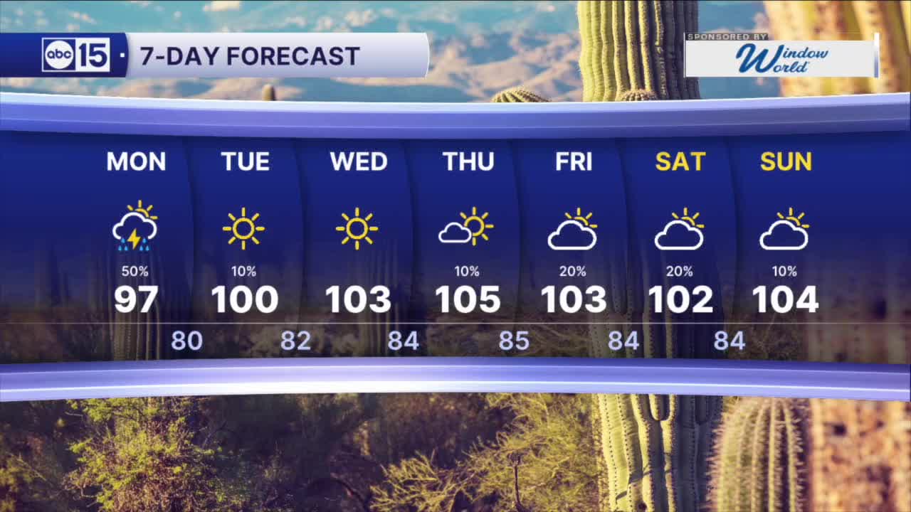
The best chance for storms comes late Sunday and Monday.
A Flood Watch is now in effect for most of Arizona, including the Phoenix Metro as storms could produce heavy rain that leads to areas flash flooding.
Storms could also produce strong winds, blowing dusts, and dangerous lightning.
As monsoon moisture goes up, temperatures are dropping in the coming days.
We could see Valley highs dip into the 90s on Monday, with near-normal highs in the low 100s for the rest of the week.
Overnights will cool into the upper 70s to low 80s, too.
Things will dry out through mid-week but we could get another boost in moisture by Thursday, bringing storm chances back through the Labor Day weekend.


2026 Sky Harbor Rainfall to-date: 1.57" (-3.15" from average)
2026 Monsoon Rainfall to-date: 1.25" (-0.52" from average)
_________________________________________
Daily rainfall reports from all across the Valley can be found here.
__________________________________________
PHOENIX IS GETTING DRIER - LOWER RAINFALL AVERAGES NOW
Average Monsoon Rainfall in Phoenix (1981-2010): 2.71" of rain
NEW Average Monsoon Rainfall in Phoenix (1991-2020): 2.43" of rain
Average Yearly Rainfall in Phoenix (1981-2010): 8:03" of rain
NEW Average Yearly Rainfall in Phoenix (1991-2020): 7.22" of rain
__________________________________________
Share your weather photos and videos with us anytime: share@abc15.com.
______________________________________
