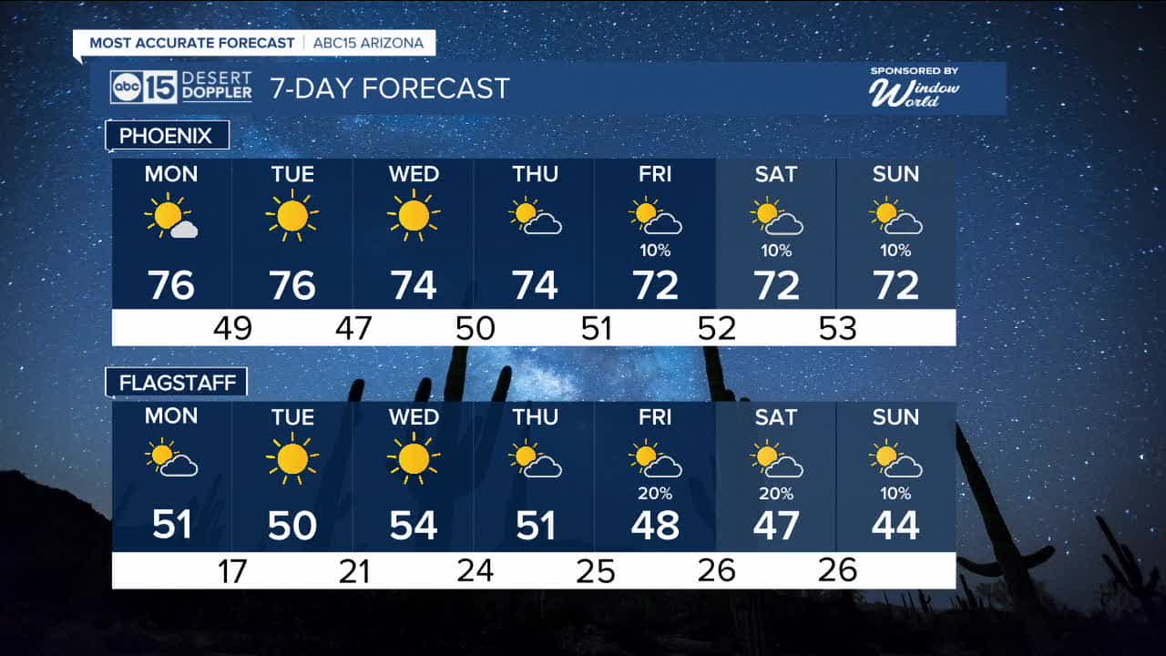


PHOENIX — As we head into the new week, a strong ridge of high pressure along the West Coast will continue to keep Arizona dry, sunny, and warmer than normal through at least midweek.
High temperatures will stay in the mid-70s on Monday, keeping Valley readings nearly 10 degrees above average. While afternoons remain warm, mornings will still feel cool, with lows dipping into the upper 40s across the Valley through midweek.
Temperatures are expected to remain fairly steady through the middle of the week, though we may see periods of increasing cloud cover at times.
Looking ahead to late next week, the ridge could begin to weaken as a cut-off low tries to move into the region. If that system comes together, it may bring a chance for rain—and possibly snow in the high country—by the end of the week and into the weekend.
That potential storm system could also knock temperatures down slightly, though highs would still run about 5 degrees above normal.
Stay tuned as we continue tracking this possible change heading toward next weekend.


2026 Sky Harbor Official Rainfall to date: 0.18" (-0.36" from average)
_________________________________________
2025 Sky Harbor Official Rainfall: 8.31" (+1.09" from average)
Monsoon 2025 Sky Harbor Official Rainfall: 2.76" (+0.33" from average)
__________________________________________
Daily rainfall reports from all across the Valley can be found here.
__________________________________________
PHOENIX IS GETTING DRIER - LOWER RAINFALL AVERAGES NOW
Average Monsoon Rainfall in Phoenix (1981-2010): 2.71" of rain
NEW Average Monsoon Rainfall in Phoenix (1991-2020): 2.43" of rain
Average Yearly Rainfall in Phoenix (1981-2010): 8:03" of rain
NEW Average Yearly Rainfall in Phoenix (1991-2020): 7.22" of rain
__________________________________________
Share your weather photos and videos with us anytime: share@abc15.com.
______________________________________
