

PHOENIX — Our latest round of rain and snow across Arizona is clearing out.
Flagstaff picked up an inch of snow on Wednesday as our Valley forecast stayed dry.
Now, colder air is settling in behind the storm and temperatures are plummeting.
Early morning lows in the Valley will fall into the upper 30s to low 40s.
Freeze Warnings are in effect for Punkin Center, Miami, Peridot, Sunflower, Globe, and San Carlos from midnight until 9 a.m. on Thursday. In these areas, remember to
"Protect the P's": people, pets, plants and pipes.
Across the high country, temperatures will fall into the teens and twenties overnight. So, bundle up!
Afternoon temperatures will only warm into the 30s along the Mogollon Rim on Thursday, so it will be cold all day.
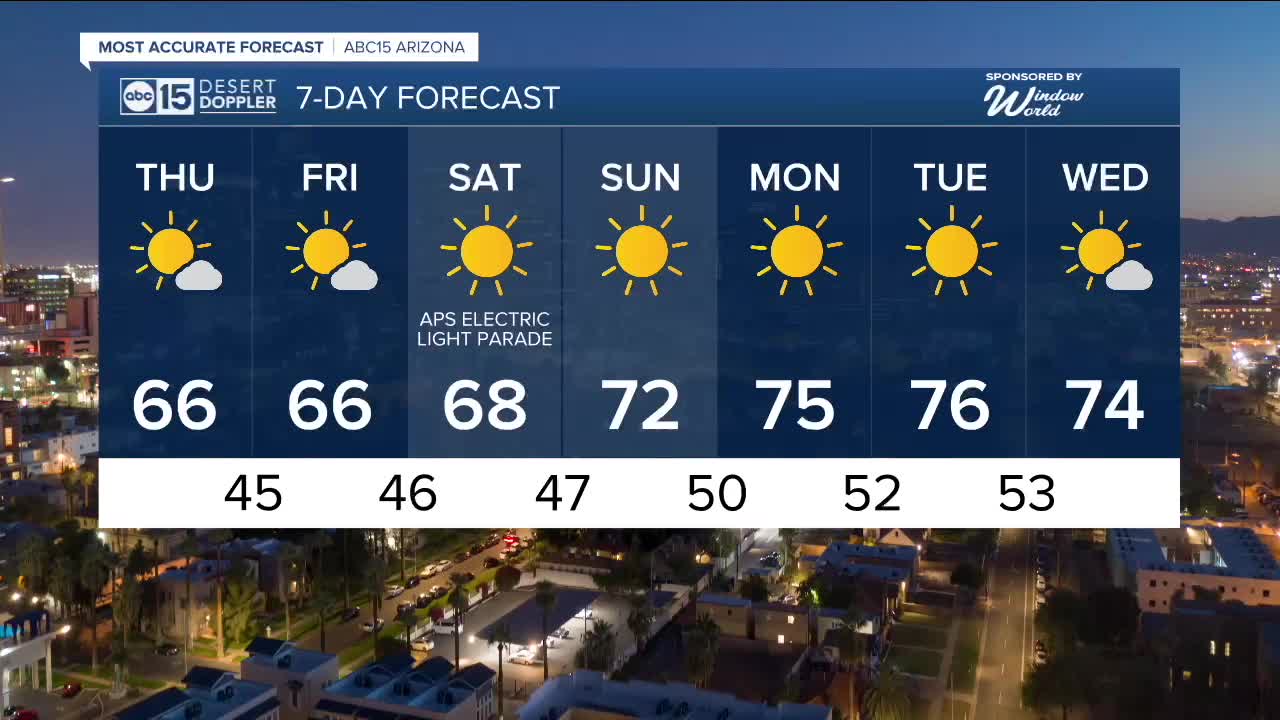
Phoenix will top out in the mid 60s, which is a few degrees below normal for this time of year.
High pressure will build back in this weekend and early next week, keeping things dry and warming us back into the 70s starting Sunday.


2025 Sky Harbor Official Rainfall to date: 8.28" (+1.73" from average)
Monsoon 2025 Sky Harbor Official Rainfall: 2.76" (+0.33" from average)
__________________________________________
Daily rainfall reports from all across the Valley can be found here.
__________________________________________
PHOENIX IS GETTING DRIER - LOWER RAINFALL AVERAGES NOW
Average Monsoon Rainfall in Phoenix (1981-2010): 2.71" of rain
NEW Average Monsoon Rainfall in Phoenix (1991-2020): 2.43" of rain
Average Yearly Rainfall in Phoenix (1981-2010): 8:03" of rain
NEW Average Yearly Rainfall in Phoenix (1991-2020): 7.22" of rain
__________________________________________
Share your weather photos and videos with us anytime: share@abc15.com.
______________________________________
