

PHOENIX — It's an ABC15 Weather Action Day!
A storm system is moving in, bringing scattered showers and thunderstorms to our state.
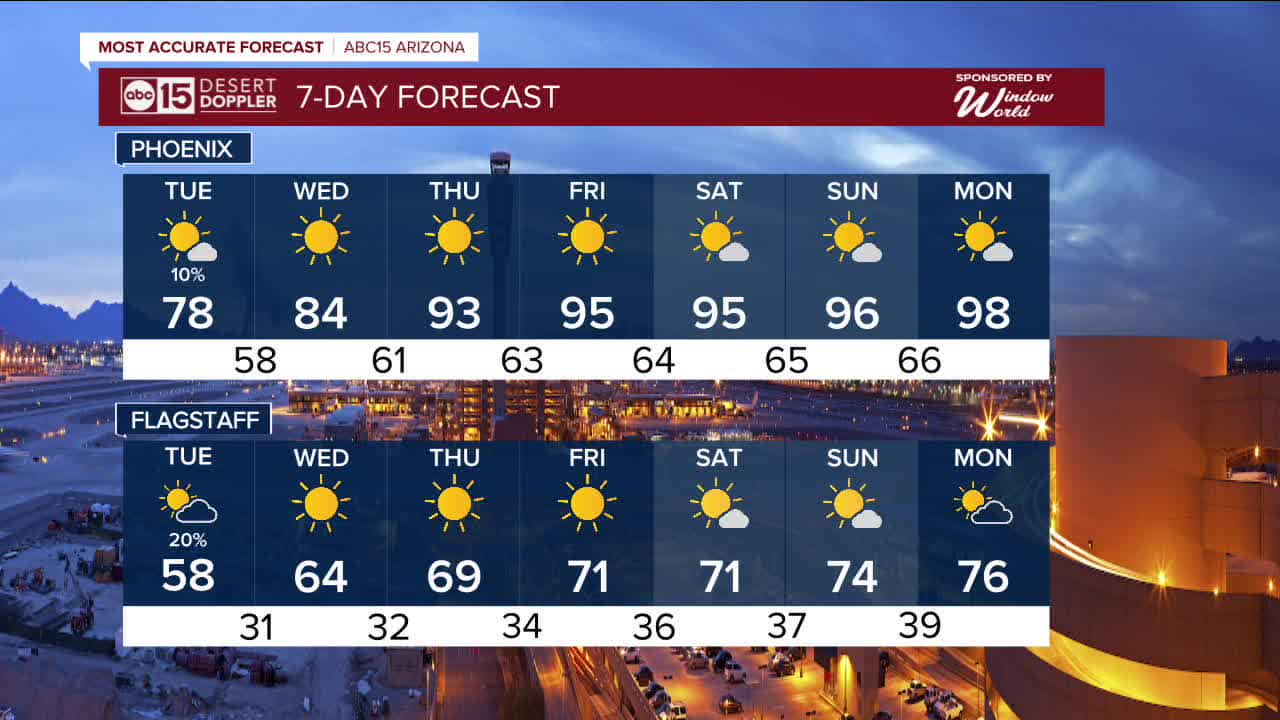
The Storm Prediction Center has issued a 'Marginal Risk' for severe storms across much of central and southern Arizona, including here in the Valley. That means, we could see thunderstorms with damaging wind gusts over 60 mph and small hail.
Rainfall totals through Tuesday morning will range from a tenth to a quarter of an inch in the Valley, with higher amounts possible with our heaviest downpours and over the higher terrain.
Once the storm moves out Tuesday afternoon, high pressure with start to build in again drying out our forecast and really heating things up.
Highs are expected to run 10 to 20 degrees above normal across the Valley by the end of the week, with new daily heat records possible heading into the weekend.
Next week it could get even hotter!
There's a chance we could see our first triple digits of the year toward the middle of next week marking the earliest 100s ever recorded in Phoenix.
Right now, the record earliest triple digit day is March 26, 1988.
In fact, that is our only triple digit day ever recorded in the month of March. But now, it's looking like we could hit 100 or hotter multiple times next week.


2026 Sky Harbor Official Rainfall to date: 0.26" (-1.78" from average)
__________________________________________
Daily rainfall reports from all across the Valley can be found here.
__________________________________________
PHOENIX IS GETTING DRIER - LOWER RAINFALL AVERAGES NOW
Average Monsoon Rainfall in Phoenix (1981-2010): 2.71" of rain
NEW Average Monsoon Rainfall in Phoenix (1991-2020): 2.43" of rain
Average Yearly Rainfall in Phoenix (1981-2010): 8:03" of rain
NEW Average Yearly Rainfall in Phoenix (1991-2020): 7.22" of rain
__________________________________________
Share your weather photos and videos with us anytime: share@abc15.com.
______________________________________
