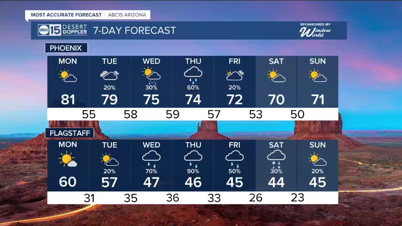


PHOENIX — Phoenix broke another record high today as we hit 81 degrees Sunday afternoon.
With high pressure still in control, we are set to break more records both Monday and Tuesday.
Monday's high of 81 could break that day's 1917 record of 79 degrees.
The record for the most 80s days in December is seven days, which occurred back in 1980. However, 2025 could end up in second or third place for the most December days in the 80s in Phoenix.
We are tracking a nice shift in the forecast by Christmas Eve and Christmas Day, though!
We've got a storm system on the way that will drop temperatures and bring chances for rain across Arizona starting Tuesday night/
Rain will come in waves through Christmas, with the highest chance the night of Christmas Eve into Christmas morning.
Valley highs will fall back into the mid-70s on Wednesday and Thursday, which is still around 10 degrees above normal.
Right now, the snow level is looking very high at 8,000 to 10,000 feet in elevation, so we'll see mostly rain from this storm in the high country too. Some snow could mix in late Friday.
Stay tuned for updates as we get closer.


2025 Sky Harbor Official Rainfall to date: 8.28" (+1.31" from average)
Monsoon 2025 Sky Harbor Official Rainfall: 2.76" (+0.33" from average)
__________________________________________
Daily rainfall reports from all across the Valley can be found here.
__________________________________________
PHOENIX IS GETTING DRIER - LOWER RAINFALL AVERAGES NOW
Average Monsoon Rainfall in Phoenix (1981-2010): 2.71" of rain
NEW Average Monsoon Rainfall in Phoenix (1991-2020): 2.43" of rain
Average Yearly Rainfall in Phoenix (1981-2010): 8:03" of rain
NEW Average Yearly Rainfall in Phoenix (1991-2020): 7.22" of rain
__________________________________________
Share your weather photos and videos with us anytime: share@abc15.com.
______________________________________
