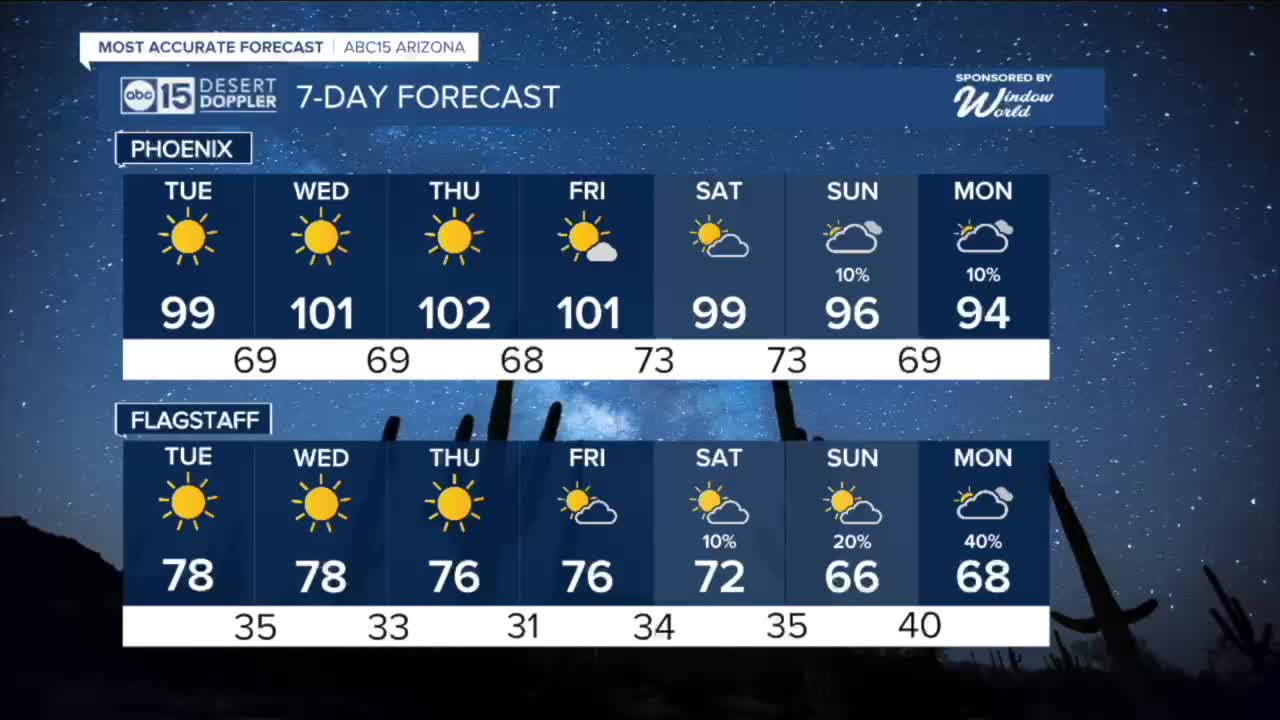


PHOENIX — Highs will ease into the upper 90s for Tuesday as the ridge of high pressure weakens.
The ridge rebuilds by midweek, pushing temperatures back into the triple digits with daily records at risk Wednesday through Friday.
We are no longer under an Extreme Heat Warning, but temperatures are still running more than 20 degrees above normal.
If you plan to be outdoors, take precautions. Limit strenuous activity during the hottest part of the day and drink plenty of water.
By the end of the weekend the ridge begins to shift east.
There are early signs that the final days of March and the start of April could bring a better chance for rain, with some cooling to follow.
Stay tuned for updates as we get closer.


2026 Sky Harbor Official Rainfall to date: 0.31" (-2.12" from average)
__________________________________________
Daily rainfall reports from all across the Valley can be found here.
__________________________________________
PHOENIX IS GETTING DRIER - LOWER RAINFALL AVERAGES NOW
Average Monsoon Rainfall in Phoenix (1981-2010): 2.71" of rain
NEW Average Monsoon Rainfall in Phoenix (1991-2020): 2.43" of rain
Average Yearly Rainfall in Phoenix (1981-2010): 8:03" of rain
NEW Average Yearly Rainfall in Phoenix (1991-2020): 7.22" of rain
__________________________________________
Share your weather photos and videos with us anytime: share@abc15.com.
______________________________________
