

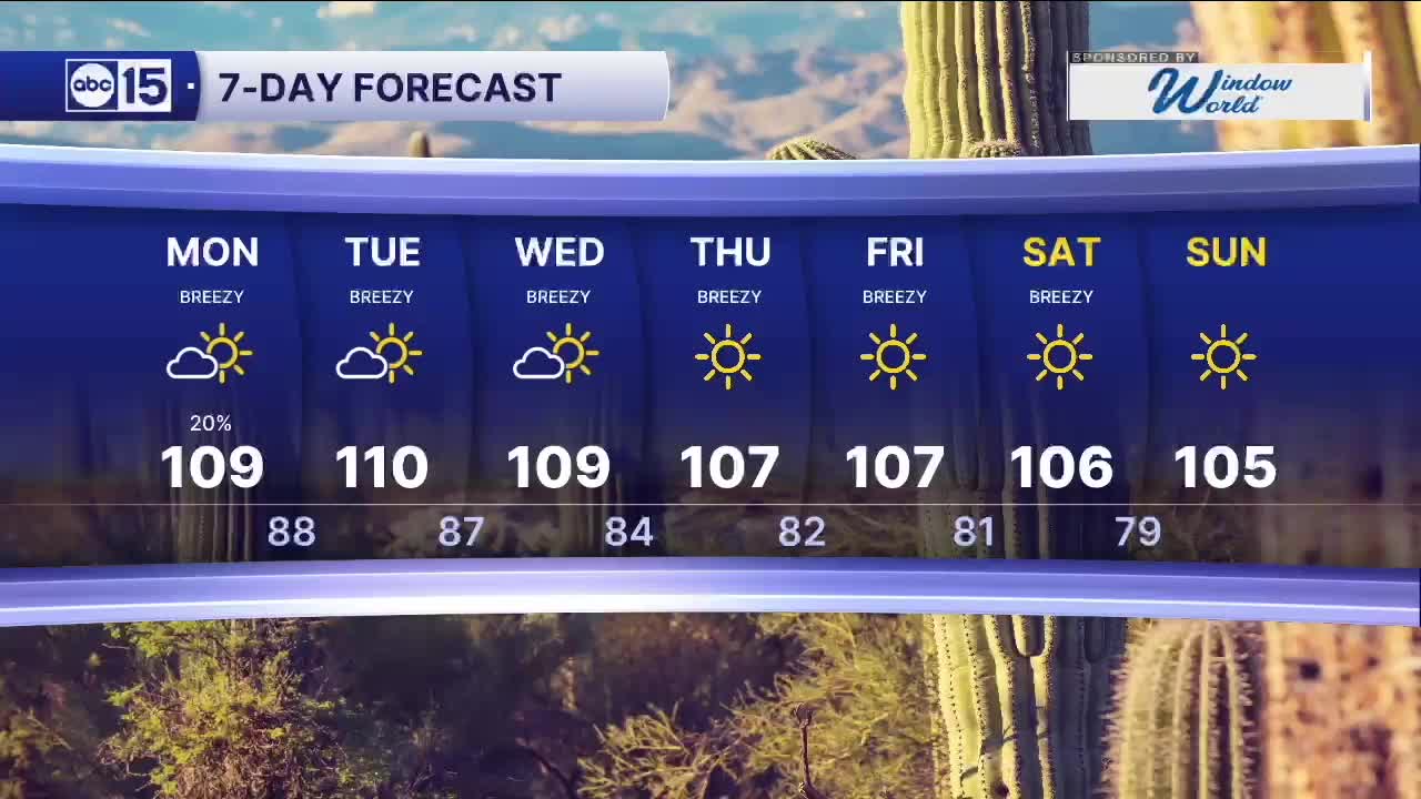


PHOENIX — After a sizzling and muggy weekend, moisture will remain available as we kick-start the monsoon season on Monday.
Showers and storms will develop near and east of the Rim in the early afternoon. A northerly to northeasterly shift in upper-level winds could send outflow boundaries from storms towards the Valley by the late afternoon to early evening.
If these outflow boundaries make it to the Valley, they could tap into the available moisture and bring some shower chances to the Valley. If it does not tap into that moisture, expect blowing dust and gusty winds in any outflow.
The other big story remains the temperatures; a major heat risk remains in place through Tuesday as temperatures in the Valley soar to near 110 degrees.
The forecast looks to dry out again toward the middle of next week as the moisture gets cut off. Temperatures here in the Valley hover around 109 or 110 through Wednesday before falling closer to normal by the end of the week and into next weekend.


2026 Sky Harbor Official Rainfall to date: 0.32" (-2.60" from average)
__________________________________________
Daily rainfall reports from all across the Valley can be found here.
__________________________________________
PHOENIX IS GETTING DRIER - LOWER RAINFALL AVERAGES NOW
Average Monsoon Rainfall in Phoenix (1981-2010): 2.71" of rain
NEW Average Monsoon Rainfall in Phoenix (1991-2020): 2.43" of rain
Average Yearly Rainfall in Phoenix (1981-2010): 8:03" of rain
NEW Average Yearly Rainfall in Phoenix (1991-2020): 7.22" of rain
__________________________________________
Share your weather photos and videos with us anytime: share@abc15.com.
______________________________________
