



PHOENIX — One more warm day before a big change in our weather!
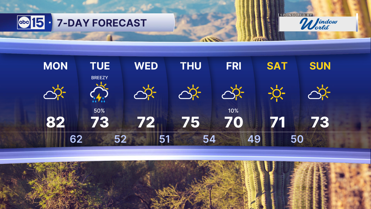
Phoenix will climb into the low 80s today, putting us a few degrees above normal for this time of year.
Our next storm system will move in on Tuesday with a cold front, dropping temperatures into the low 70s and bringing a chance of rain back to the Valley.
Showers are most likely Tuesday morning, and a few storms are possible. Most of us will see around a tenth of an inch of rain, with some spots getting up to a quarter of an inch.
Gusty winds will also develop on Tuesday. Gusts in the high country could top 40 mph.
Up north, the snow level will start very high, so most of the high country will see rain too. Only the highest peaks could pick up more than an inch of snow.
A second, colder storm will move through to our north Thursday night into Friday. It could bring a light dusting to Flagstaff on Friday morning, which would be the first snowfall of the season.
Temperatures will stay a few degrees below normal through the weekend.
Stay tuned for updates as we get closer.


2026 Sky Harbor Official Rainfall to date: 5.00" (-1.19" from average)
Monsoon 2026 Sky Harbor Official Rainfall: 2.46" (+0.03" from average)
__________________________________________
Daily rainfall reports from all across the Valley can be found here.
__________________________________________
PHOENIX IS GETTING DRIER - LOWER RAINFALL AVERAGES NOW
Average Monsoon Rainfall in Phoenix (1981-2010): 2.71" of rain
NEW Average Monsoon Rainfall in Phoenix (1991-2020): 2.43" of rain
Average Yearly Rainfall in Phoenix (1981-2010): 8:03" of rain
NEW Average Yearly Rainfall in Phoenix (1991-2020): 7.22" of rain
__________________________________________
Share your weather photos and videos with us anytime: share@abc15.com.
______________________________________
