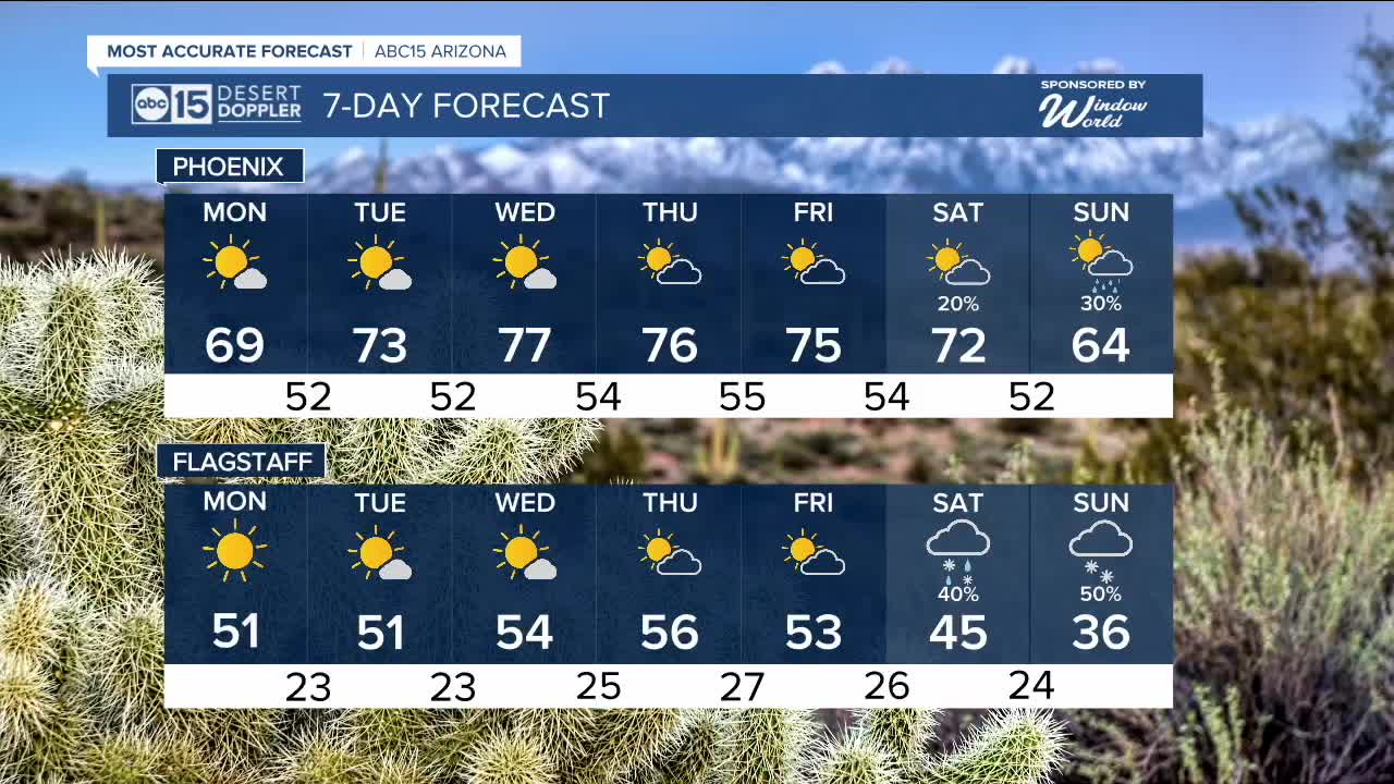


PHOENIX — Our third and final storm system of the week is moving out of the state. High pressure will build in through the midweek, bringing drier conditions and a gradual warmup.
As the ridge strengthens, temperatures will climb. Monday will start chilly, with lows in the upper 40s to low 50s across the Valley. Sunshine returns in the afternoon, but highs will only reach the upper 60s.
Temperatures will continue to warm through midweek. By Thanksgiving morning, lows will be in the mid-50s, with partly sunny skies and afternoon highs in the mid-70s.
Late next week and into next weekend, temperatures will dip again as another storm system moves in, bringing a return of rain and snow chances by the end of the weekend.


2025 Sky Harbor Official Rainfall to date: 8.28" (+1.96" from average)
Monsoon 2025 Sky Harbor Official Rainfall: 2.76" (+0.33" from average)
___________________________________________
Daily rainfall reports from all across the Valley can be found here.
__________________________________________
PHOENIX IS GETTING DRIER - LOWER RAINFALL AVERAGES NOW
Average Monsoon Rainfall in Phoenix (1981-2010): 2.71" of rain
NEW Average Monsoon Rainfall in Phoenix (1991-2020): 2.43" of rain
Average Yearly Rainfall in Phoenix (1981-2010): 8:03" of rain
NEW Average Yearly Rainfall in Phoenix (1991-2020): 7.22" of rain
__________________________________________
Share your weather photos and videos with us anytime: share@abc15.com.
______________________________________
