



PHOENIX — Monsoon moisture is flowing in and the risk of flash flooding is increasing.
Parts of southern Arizona are under Flood Watches until 5 a.m. Friday.
While the Valley is not under a Flood Watch, there is still a chance of storms overnight into early Friday morning.
Any storms that move through could bring pockets of heavy rain, wind gusts over 40 mph and dangerous cloud-to-ground lightning.
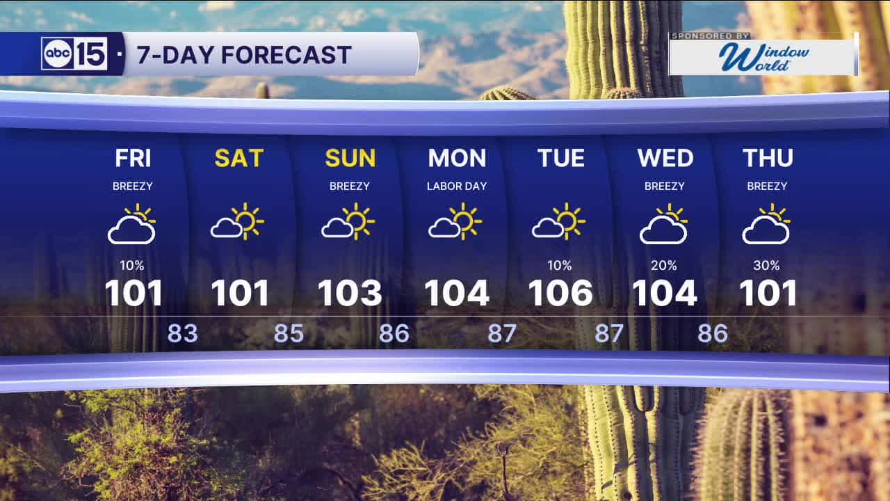
We'll continue to see slight chances for storms across the high country and southeastern Arizona through Labor Day weekend, but our Valley forecast looks to stay dry Saturday, Sunday and Monday.
Temperatures will stay near or slightly below normal with Valley highs in the low 100s through the holiday weekend.
Overnight lows will drop into the upper 70s to mid 80s across the Valley over the next several nights.


2026 Sky Harbor Rainfall to-date: 1.73" (-3.13" from average)
2026 Monsoon Rainfall to-date: 1.41" (-0.53" from average)
__________________________________________
Daily rainfall reports from all across the Valley can be found here.
__________________________________________
PHOENIX IS GETTING DRIER - LOWER RAINFALL AVERAGES NOW
Average Monsoon Rainfall in Phoenix (1981-2010): 2.71" of rain
NEW Average Monsoon Rainfall in Phoenix (1991-2020): 2.43" of rain
Average Yearly Rainfall in Phoenix (1981-2010): 8:03" of rain
NEW Average Yearly Rainfall in Phoenix (1991-2020): 7.22" of rain
__________________________________________
Share your weather photos and videos with us anytime: share@abc15.com.
______________________________________
